Incident Code
Incident Date
Location
Geolocation
Geolocation
Airwars Assessment
(Previous Incident Code: YEMT058 )
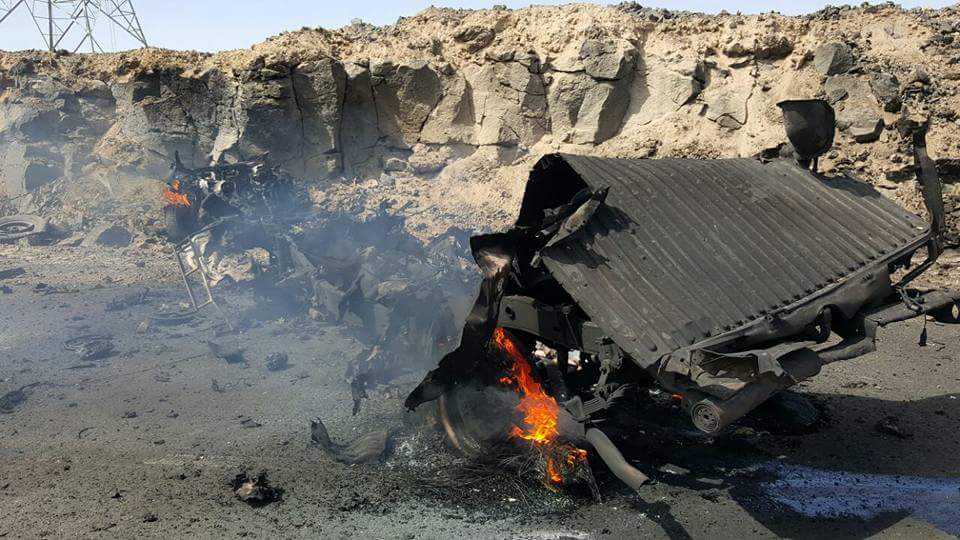
A reported US drone strike targeted alleged AQAP militants travelling in a vehicle on the road connecting Wadi Nakhla to Al Suhail, in the Sirwah district of Marib governorate, early on March 30th 2017. There were no known associated reports of civilian harm.
While most sources indicated that the strike was launched by a US drone, one did assign it to “Saudi-American aggression”. Multiple sources reported that the vehicle was targeted while travelling on the Al Suhail and Nakhla road. Some claimed that the vehicle was carrying “heavy weapons”.
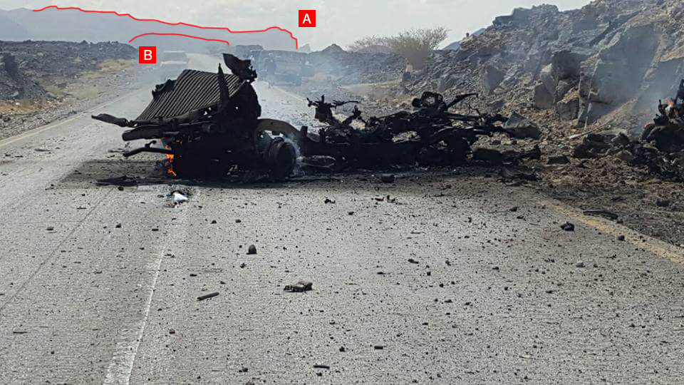
Images from the scene show total destruction of the vehicle, indicating that those inside were killed. Airwars has therefore set the belligerent toll at one to two deaths in this case. Images of the scene also enabled Airwars precisely to geolocate this incident (see below.)
This reported event took place amid a dramatic intensification of US operations against AQAP beginning in early March 2017. On April 3rd, Pentagon spokesperson Captain Jeff Davis said that, from February 28th to the final week of March, fifty US airstrikes were conducted in Yemen.
Geolocation Notes
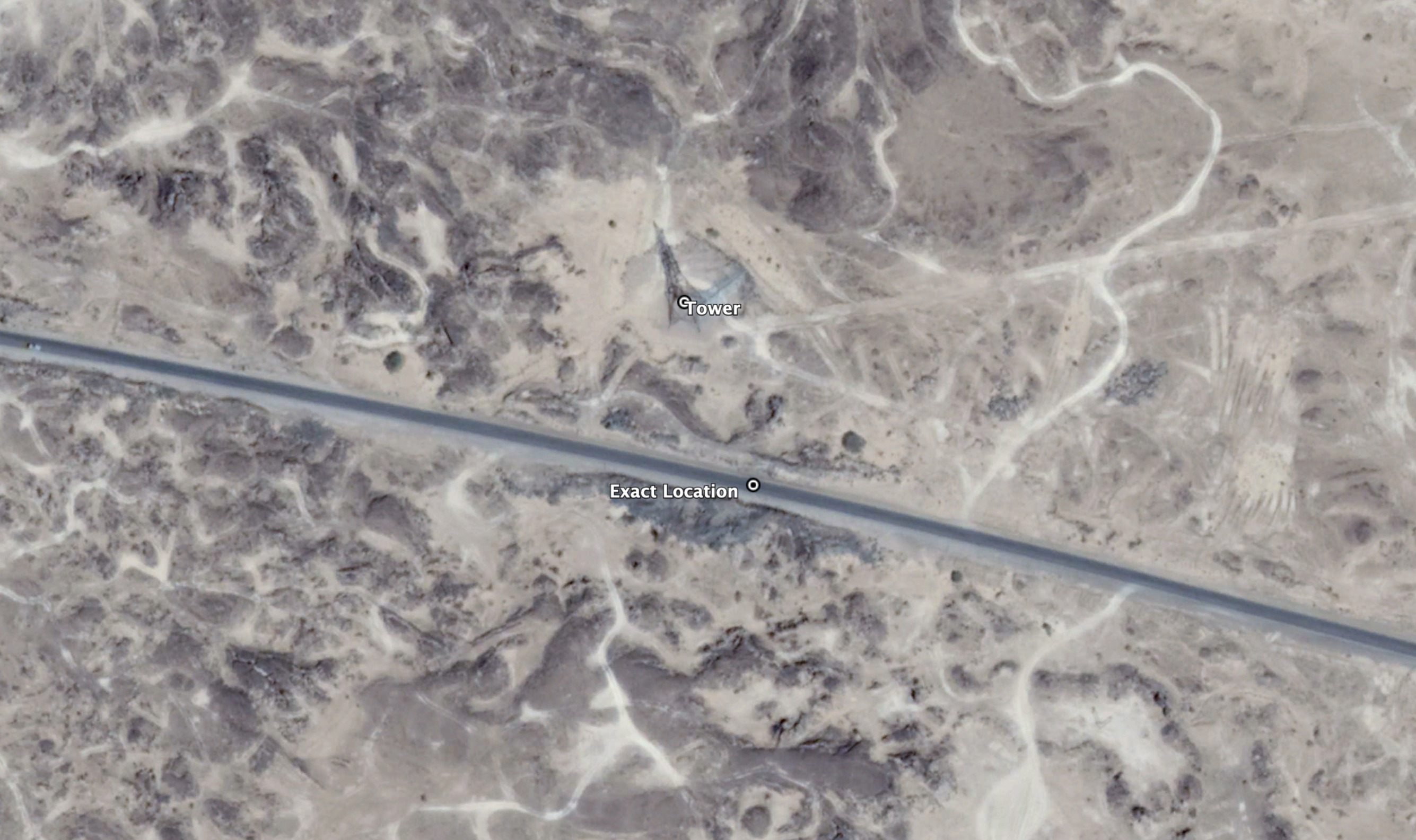
Reports of the incident mention a vehicle being struck on the road connecting Wadi Nakhla (وادي نخلا) to Al Suhail (السحيل), within the Sirwah (صرواح) district of Marib (مَأْرِب) governorate. Analyzing available visual material and using mapping resources, we narrowed this down to an exact location, for which coordinates are: 15.5000139, 45.2216056.
Reports of the incident mention a vehicle being struck on the road connecting Wadi Nakhla (وادي نخلا) to Al Suhail (السحيل), within the Sirwah (صرواح) district of Marib (مَأْرِب) governorate. Analyzing available visual material and using mapping resources, we narrowed this down to an exact location.
Imagery: Google Earth

Exact location of the wreckage, in relation to Wadi Nakhal (وادي نخلا) to Al Suhail (السحيل).
Imagery: Google Earth
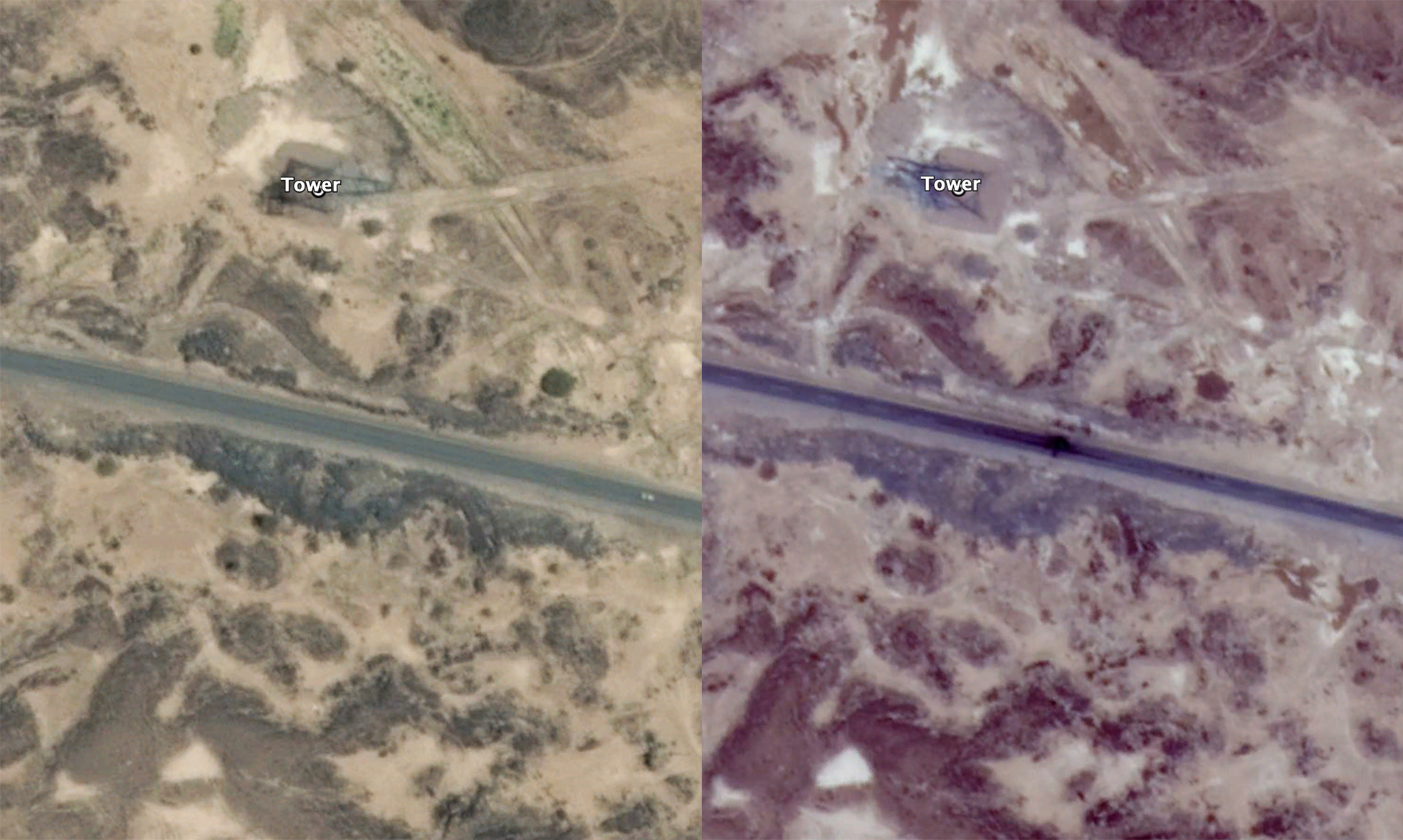
Comparison of satellite imagery. On the left a capture from May 5th 2016, and on the right a capture from March 31st 2017, a day after the alleged strike. Visible scorch marks as a result of the strike can be seen.
Imagery: Google Earth
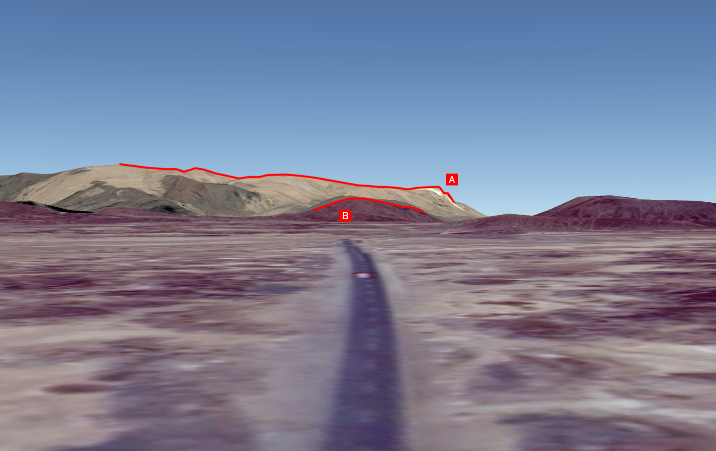
Hills in the distance can be seen matching the Google Earth terrain visualisation, here marked A and B for comparison.
Imagery: @demolinari
Hills in the distance can be seen matching photographic material from sources, here marked A and B for comparison.
Imagery: Google Earth
The tower in the background matches those visible from satellite imagery, and is the closest to the road in that area.
Imagery: @demolinari