Incident Code
Incident Code
Incident Date
Location
Geolocation
Geolocation
Airwars Assessment
(Previous Incident Code: LC068)
Social media sources reported two LNA airstrikes in Al-Fatayih East of Derna with a MiG-21 and a MiG-23BN.
Press Solidarity reported that the Irsa School for Girls in Al-Fatayih had to shut down temporarily as it was constantly hit by shrapnel from the bombing but didn’t mention any civilian harm: “The school administration explained on Thursday that the suspension of the study was to protect the safety of the students and the school staff as a result of the school’s exposure during the working hours of the fall of a large number of shrapnel on the building and the windows of the classrooms and in the yards of the school.”
Libya News Today reported that civilian house was destroyed and damaged by the strikes: “A military aircraft belonging to Omar al-Mukhtar’s operation room, MiG-21, shelled an area near civilian houses on Wednesday, destroying a house and damaging other houses.”
Key Information
Geolocation Notes
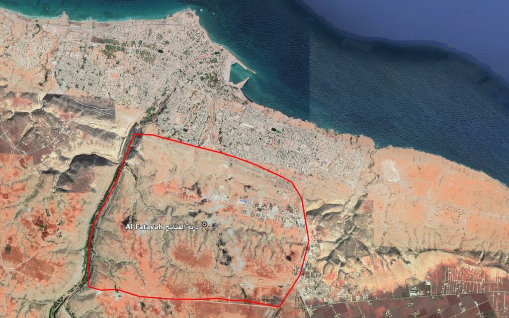
Reports of the incident mention the neighbourhood of Al Fatayah (درنة الفتايح), for which the generic coordinates are: 32.733611, 22.645278. Due to limited satellite imagery and information available to Airwars, we were unable to verify the location further.

Reports of the incident mention the neighbourhood of Al Fatayah (درنة الفتايح).
Imagery: Google Earth
