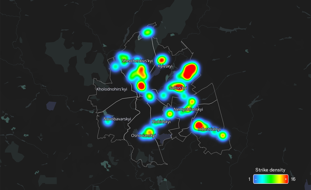
Highest rates of civilian harm found in the city of Saltivskyi

As part of our on-going research mapping the human cost of war in urban environments, the following visualisation demonstrates all civilian casualty allegations in the densely populated city of Kharkiv between February 24th to May 13th 2022.
Airwars documented 68 incidents of civilian harm reported by local sources in Kharkiv city during the intense campaign, accounting for at least 83 casualties and up to 365 civilians injured.
In Kharkiv city, the highest number of incidents of civilian harm were reported in Saltivskyi, in Kyivsky and Shevchenkivskiy city districts, the northern and eastern parts of the city. In September 2022, Kharkiv Mayor Ihor Terekhov said in an interview that ‘there are some residential areas where there is nothing left’.
This visualisation accompanies Airwars’ casualty archive for Ukraine. Read more in our research brief here, and navigate the full archive here.