Incident Code
Incident Code
Incident Date
Location
Geolocation
Geolocation
Airwars Assessment
(Previous Incident Code: LG007d)
On April 5th 2011, two civilians were reported killed and 26 injured as a result of artillery shelling by Gaddafi forces on the city of Misurata. The bombing was said to have started at 10am.
According to Al Jazeera, “A Libyan rebel said today, Wednesday, that two people were killed and 26 wounded in artillery shelling launched by the security brigades loyal to Colonel Muammar Gaddafi on the city of Misrata.”
Another rebel man said, “The pro-Gaddafi forces bombed Misrata, but the bombing has now stopped … The attacks were mainly around the port and the Tripoli Street area near the city centre.”
The man, Abd al-Salam, said in a phone call to Reuters that Misrata was bombed by tanks, artillery and mortar shells, mainly in Tripoli Street and the Mina area, noting that the bombing began at ten in the morning yesterday and stopped at five in the afternoon the same day.
There is currently no further information available.
Key Information
Geolocation Notes
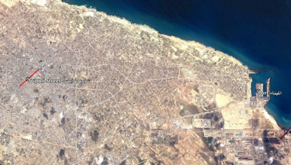
Reports of the incident mention strikes around the port (الميناء) area and Tripoli street (شارع طرابلس) in the city of Misurata (مصراتة). Due to limited satellite imagery and information available to Airwars, we were unable to verify the location further. The generic coordinates for the port of Misurata are: 32.363523, 15.218700. The generic coordinates for Tripoli street are: 32.369469, 15.083981.

Reports of the incident mention strikes around the port (الميناء) area and Tripoli street (شارع طرابلس) in the city of Misurata (مصراتة).
Imagery: Google Earth
