Incident Code
Incident Date
Location
Geolocation
Geolocation
Airwars Assessment
During the afternoon of Tuesday, 17th of October, 2023, at least ten civilians were killed and dozens were injured in an alleged Israeli airstrike on an UNRWA school located in the al-Maghazi refugee camp in the central Gaza Strip where 4,000 people were taking refuge. However, the death toll may be significantly higher as Twitter/X user @alforgannet wrote that “a large number of civilians, most of them children and women, were martyred and injured.”
The school was run by the United Nations Relief and Works Agency for Palestine Refugees. Al-Ahram news quoted UNRWA as saying, “At least six people were killed this afternoon as a result of the bombing of an UNRWA school in the Maghazi refugee camp in the central region of Gaza.” The source also referenced the statement made by the organization’s Commissioner-General, Philippe Lazzarini, who corroborated that dozens, including UNRWA employees, were injured and that “the school had suffered severe structural damage.” The statement suggested that the casualty numbers were likely to be higher. Urgent From The Rest reported about 10 civilians killed and dozens wounded.
WAFA News Agency and Facebook user “Going Back to Palestine” shared the images showing the aftermath of the deadly strike: the walls of the school with large holes in them, lots of broken furniture and rubble. A graphic video posted by Electronic Al-Nadaa Portal on Facebook showed bodies being carried out of the school.
The sources differed about the nature of the strike. The Palestinian Ministry of Interior and National Security and some local sources said that the school was hit with artillery while UNRWA reported an airstrike.
Where sources identified the belligerent, all sources attributed the strikes to Israeli forces.
Key Information
Geolocation Notes
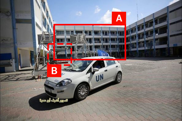
Reports of the incident mention the Al Maghazi Preparatory School for Boys (مدرسة المغازي الاعدادية للبنين) to the east of Deir al Balah (دير البلح). Analysing audio-visual material from sources, we have narrowed the location down to the following exact coordinates: 31.420102, 34.388679.

Imagery: Hany Abu Zeid
