Incident Code
Incident Code
Incident Date
Location
Geolocation
Geolocation
Airwars Assessment
(Previous Incident Code: LN060 )
According to various sources mostly affiliated with the Gaddafi regime, family members residing in neighbourhood number 3 in front of Al Sa’a (clock) tower, Sirte, were injured and some killed due to an attack launched by NATO in September 25th 2011.
It is unclear due to contradicting sources, whether Sarah Ahmed Abd al-Mawli Yunus and Muhammad Ahmed Abdel-Mawali Younes were killed or severely injured.
NATO on that day reported hitting: “1 command and control node, 2 ammunition/vehicle storage facility, 1 radar facility, 1 multiple rocket launcher, 1 military support vehicle, 1 artillery piece, 1 ammunition storage facility.” in the vicinity of Sirte.
There is no further information currently available.
Victims
Family members (6)
Geolocation Notes
Reports of the incident mention a clock tower in the third neighbourhood (الحي رقم 3) of Sirte (سرت). Research shows the presence of a clock tower adjacent to the neighbourhood mentioned but we are unable to confirm if this is the clock tower referred to by the sources. Due to limited satellite imagery and information available to Airwars, we were unable to verify the location further. The coordinates for the clock tower are: 31.201721, 16.592180.
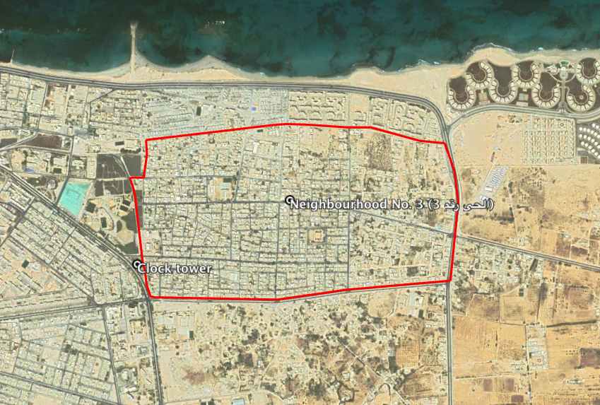
Reports of the incident mention a clock tower in the third neighbourhood (الحي رقم 3) of Sirte (سرت). Research shows the presence of a clock tower adjacent to the neighbourhood mentioned but we are unable to confirm if this is the clock tower referred to by the sources.
Imagery: Google Earth