Incident Code
Incident Date
Location
Geolocation
Geolocation
Airwars Assessment
(Previous Incident Code: RUK0075)
One civilian was wounded by alleged Russian shelling of school no. 35 on Lymanskyi Lane in Kharkiv on March 16, 2022.
Helsinki.org.ua reported that at 3am Russian shelling hit a three-story part of a school, destroying an area of 800 square meters and injuring one civilian. The same source reported that later the same day, at 4:56 p.m, School 35 in Kharkiv, Lymanskyi Lane, was destroyed by an aerial bomb. It is unclear if this is related.
Vgorode.ua added that according to residents of Kharkiv, the school was located in Osnova district.
According to Suspilne News, parents of the students helped clean up the rubble of the destroyed school following the shelling.
The majority of sources that reported on the incident attributed the shelling to Russian forces. However, Perviy Kharkovskyi, a Telegram account with a clear pro-Russian stance, posted on Telegram that the school was hit by the Ukrainian forces.
This assessment has reference to ACLED code UKR53554.
Key Information
Geolocation Notes
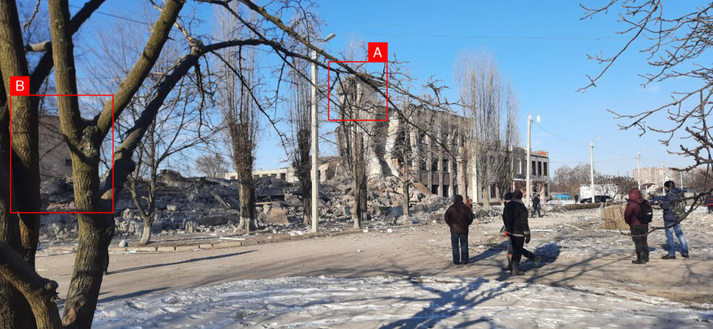
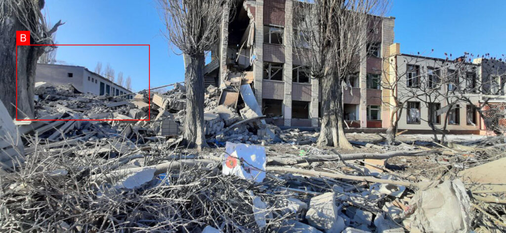
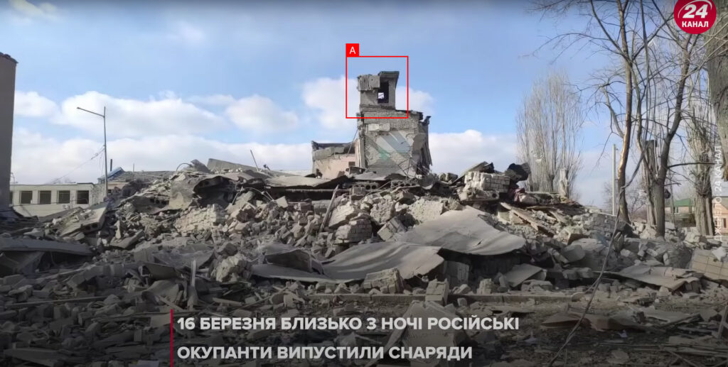
Reports of the incident mention the school no. 53 on Lymanskyi Lane (провулок Лиманський). Analysing audio-visual material from sources we have narrowed down the location to these exact coordinates: 49.935831, 36.252344.

Imagery: Sunlitkh

Imagery: Sunlitkh

Imagery: 24 Channel
