Incident Code
Incident Date
Location
Geolocation
Geolocation
Airwars Assessment
(Previous Incident Code: RUK0094)
On March 25th 2022 at approximately 7:45am, Russian forces reportedly shelled the Osnovyansk district of Kharkiv, Ukraine, killing between four and five civilians and injuring three more. The shelling involved artillery fire on residential buildings and a city clinic dispensing humanitarian aid, with some sources referring to it as medical aid, damaging civilian’s houses and vehicles in its wake.
Initial reports put the death toll at 4, as noted by Informator.ua news who reported the shelling hit the clinic with rocket launchers, and resulting in the deaths of four civilians and injuries to three others. However, reports the following day from Allkharkov News stated that five civilians had been killed in the shelling.
Reports indicate that the strike hit the clinic where the center for issuing humanitarian aid was located, despite the absence of any Ukrainian military in the vicinity. Gazeta News reports that in response to this, an investigation was launched by the Kharkiv Regional Prosecutor’s Office. The investigation is currently ongoing, with law enforcement officials gathering evidence to bring the perpetrators to justice.
The strike in the Osnovyansk district is just one of many attacks that have occurred in the area that day. Oleg Sinegubov, the head of the Kharkiv Regional Military Administration, said that Russia uses “Hail” and “Uragan” rocket salvo systems in Kharkiv without specifying if they were used during this attack, and other sources attributed the attack to rockets. All of the sources blamed “Russian forces” or the “occupiers” for the shelling.
This incident has ACLED’s reference codes UKR54070 and UKR54607 and Bellingcat’s code CIV0556.
Key Information
Geolocation Notes
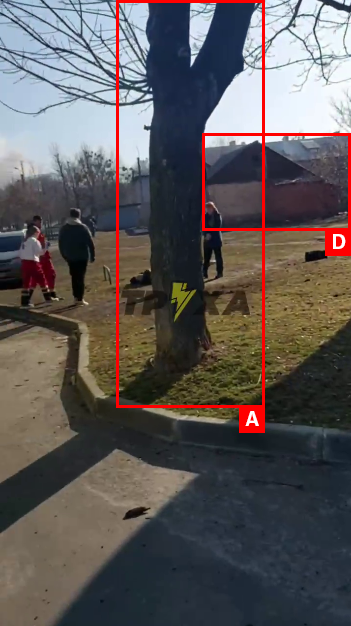
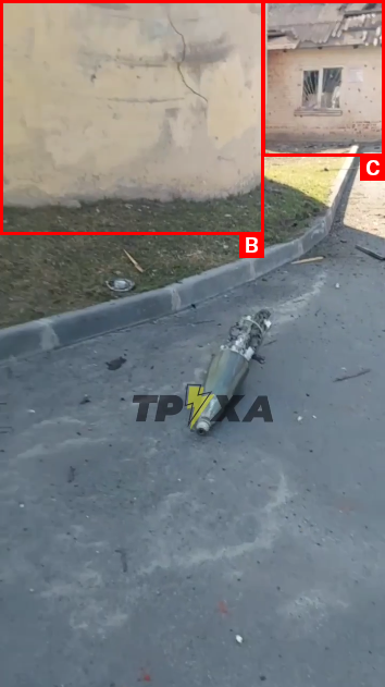
Reports of the incident mention a clinic in the Osnovyansk (Основ’янськ) district of Kharkiv (Харків). Analysing audiovisual material from sources, we have narrowed the location of at least one of the casualties down to the following exact coordinates in the vicinity of City Hospital No.1 (Міська лікарня №1): 49.928187, 36.257216.

Tagged visual material from sources
Imagery: Truexanews

Tagged visual material from sources
Imagery: Truexanews
