Incident Code
Incident Date
Location
Geolocation
Geolocation
Airwars Assessment
(Previous Incident Code: SOM079 )
On December 27th 2017, AFRICOM reported that it had “conducted an airstrike against al-Shabaab militants on the morning of Dec. 24, 2017, in southern Somalia”.
AFRICOM made no mention of civilian harm. However, it claimed that the strike had killed “13 terrorists”. The strike hit southern Somalia according to officials, though no additional location details were provided at the time.
VOA reported that the action had been conducted by a drone: “‘The strike targeted the militants as they mobilized to launch an attack against our base. Fortunately, the military from a friendly nation disabled them with a drone strike and killed 13 of them,’ a Somali military commander in the area told VOA.”
The Daily Nation, a Kenyan news site, later said the strike had hit an al Shabaab training camp which they located in Ball Raho. It reported that two Kenyan nationals were “among Shabaab terrorists” injured in the strike and were currently being treated at an Al Shabaab operated medical facility, citing a document shared among Kenyan security.
The report by the Daily Nation named the two injured “terrorists” as Mohamed Ahmed Farah alias Mohamed Kheir, and Abdullahi Wilif from Wajir County.
In a subsequent FOIA response obtained by journalist Joshua Eaton in May 2019, AFRICOM confirmed it had struck what it says were al Shabaab fighters on this date, in the vicinity of Qudus, Somalia.
Geolocation Notes
Reports of the incident mention a few different locations, saying that the target of the strike was a training camp called Bohadi, at Ball Raho, supposedly located between the towns Busaar and Burahache or Elwak in the Gedo region. A subsequent FOIA response pointed to the vicinity of Qudus. Due to limited information available to Airwars, we weren’t able to verify the locations of Qudus, Bohadi or Ball Raho. Various mapping sources point out that the town of Burahache also carries the name Ceel Waq (or Elwak), the coordinates for this town are: 2.792781, 41.012850. The coordinates for the village Buusaar are: 2.67191, 41.32213. The stretch of road between these two settlements is approximately 36 kilometers long, the coordinates for the middle point of that road are: 2.742050, 41.166306. The report also mentions that the target was ‘located between Aus Qurun and Wargadud’, which describes a larger area. The coordinates for Aus Qurun (or Cows Qurun) are: 2.21022, 41.15073. The coordinates for Wargadud are: 3.2197, 43.28872.
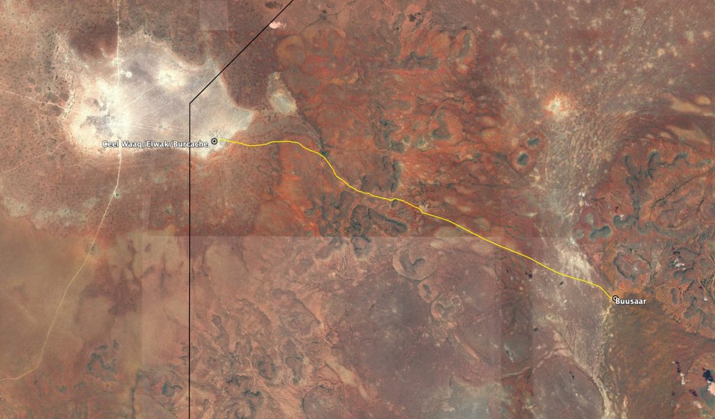
Road between Burcache/Ceel Waaq and Buusaar, near the Somalian-Kenyan border (marked in black)
Imagery: Google Earth
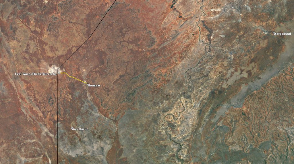
Area between Aus Qurun and Wargadud in relation to the road between Burcache/Ceel Waaq and Buusaar
Imagery: Google Earth