
How open source techniques can track, record and verify civilians killed at sea
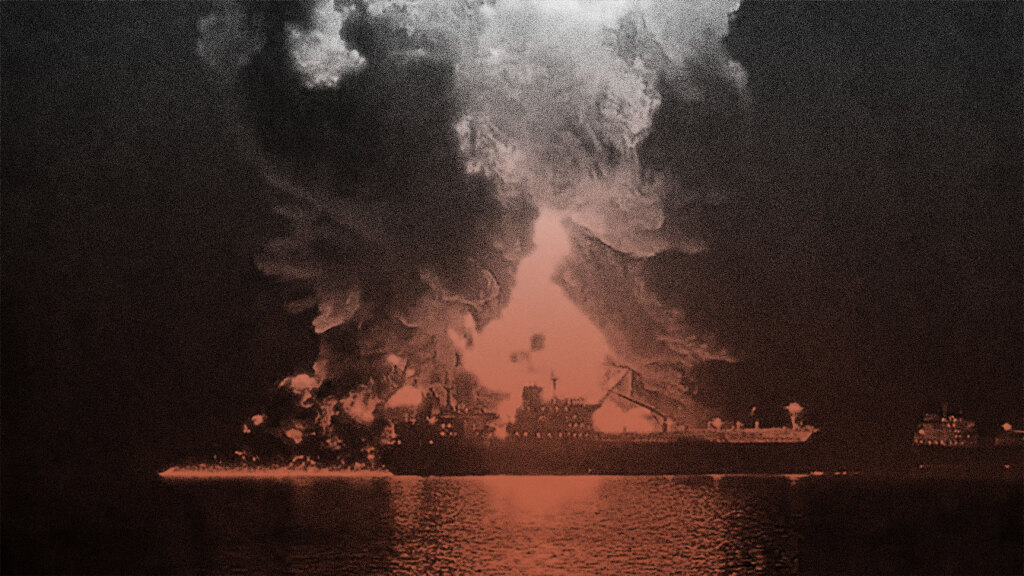
Attacks on vessels were recorded throughout the US, Israel and Iran war in 2026, with more than 20,000 seafarers reported stranded by the hostilities.
Airwars’ maritime tracking methodology is in its early development, informed by our recent documentation effort relating to US strikes in the Caribbean and Pacific, and now honed with the latest Iran War.
In researching events at sea in this campaign, Airwars has taken the same overarching approach as our land based methodology (including casualty ranges and grading systems), which can be read in detail here, with a methodology note for the 2026 war available here.
However the maritime environment also reflects a unique information and event landscape. Capturing the particularities of how civilian harm unfolds at sea requires a distinct approach in order to make sense of harm patterns, to identify potential perpetrators and ultimately ensure accountability for those harmed.
Points of divergence with Airwars’ land-based methodology are outlined below:
Geolocation
Pinpointing the coordinates of a particular incident carries greater complexity than land based approaches, with few witnesses or open sources capturing each incident to provide the clues needed for geolocation. Airwars has opted for the most common names of bodies of water to correspond with commercial maps (such as Google maps), though as we develop our methodology we will likely realign to standardised naming conventions such as that laid out by the International Hydrographic Organization.
Maritime geolocation is more of an all-source effort than land-based geolocation, which relies more heavily on imagery and video. Many of the vessels affected in this conflict were broadcasting their positions over AIS, a public, self-reported feed with no real equivalent in open-source land geolocation. When that signal is not degraded by spoofing or interference, AIS positions are accurate to within roughly 10 metres.
Importantly, the location of a vessel has jurisdictional implications for accountability and investigation, with a complex map of territorial waters, economic zones and contiguous areas providing overlapping boundaries by which vessels may be located.
As such, when Airwars finds that a vessel is struck within a state’s territorial waters (i.e., within 12 nautical miles of its shoreline, such as at a port), the incident location is coded to include both the state whose territorial waters the incident occurred in and the relevant body of water, where known.
Example incident
Additional coding fields
Alongside Airwars’ standard codebook, our evolving codebook for maritime strikes now includes additional fields to better capture each event. These include vessel names, flag states, insurers, as well as new territorial labels as outlined above. This information is typically identified using the site Equasis. These fields are displayed within each incident.
Incident detection
Airwars’ specialist maritime research team tracks key sources in order to detect incidents, including sites such as the UK’s Maritime Trade Operations Centre (UKTMO). Official sources such as these are often related to security and mutual-aid reporting bodies.
Complementing these semi-official channels are a number of platforms relating to content produced by and for seafarers, often relating to shipping practices and trade routes. These include tracking platforms covering marine traffic routes, as well as trade publications and union-reported summaries.
Often those harmed on vessels originate from countries around the world. Airwars’ researchers also look across local media of the crew’s nationalities to identify affected seafarers and establish biographical details.
In line with Airwars’ standard methodology, Airwars seeks sources made by parties to the conflict in order to attribute harm. Iranian state media, for example, provided sporadic updates on vessels it hit during the campaign.
As with all Airwars’ incidents, each source used to support every civilian harm event is included in our published incident.
Quantifying civilian harm
In quantifying civilian harm at sea, Airwars has adopted a similar methodology applied to US strikes in the Caribbean and Pacific, which can be viewed here.
Missing seafarers
When seafarers have been reported as missing and no additional reporting regarding rescue operations has been published, missing seafarers have been recorded among an incidents count of civilian fatalities. When documenting live, Airwars has opted for a 96 hour waiting period before assuming the death of missing seafarers.
Rescuing seafarers
When sources report that rescued seafarers have suffered adverse medical effects or required any kind of medical intervention, they have been recorded among the count of civilian injuries. This may contradict sources noting that rescued seafarers did not require hospitalisation and were therefore “unharmed”.
Belligerent attribution
In line with Airwars’ standard land-based methodology, incidents will only be categorised as ‘declared’ if officials acknowledge incident-level events. Where sources fail to attribute harm to any specific belligerent, strike status will be recorded as ‘contested‘, incident status ‘fair‘, and the three main parties to the conflict – Iran, Israel, and U.S. Forces – will be recorded as possible belligerents.
Example incident