Incident Code
Incident Date
Location
Geolocation
Geolocation
Airwars Assessment
On 27th September 2024, two to three civilians were reportedly killed and as many as three injured in a declared Israeli drone or air strike on a car in or near the town of Sarbin in the Nabatieh Governorate of southern Lebanon.
Whilst some sources such as the Echo of Dahieh Page Telegram channel and Jordanian news outlet Hala reported that two people were killed, multiple others, such as the Lebanese news site Jezzine Tahki, reported that three people had been killed in the strike.
Although the majority of sources reported that the incident was a drone strike, Khabar24 News, posting on Twitter/X, suggested that it was an airstrike. There were no details of the victims publicly available, though this assessment will be updated if additional information emerges.
A photograph of the aftermath of the incident, shared on the Echo of Dahieh Page Telegram channel and by other sources, showed the damaged car, which had run off the road in the aftermath of the incident.
The ‘Civil Defense Kafra’ Facebook account posted a review of the crew’s activities on the Wadi al-Ayoun / Sarbin Road the day prior. The account reported that “ThThe Kifra Martyrs Brigade, using ambulance 540” responded to the airstrike and transported three injured individuals to “the Government Hospital.” As no other sources mentioned injuries, a range of injuries (0-3) has been recorded, in line with Airwars’ methodology.
The team also reportedly worked to “reopen roads blocked by airstrikes.” The post is accompanied by an image of the 540 ambulance parked outside of the “Tibnine Governmental Hospital” (مستشفى تبنين الحكومي), as well as another image of a vehicle – presumably ambulance 540 – parked on the road, the struck car sitting haphazardly in the enbankment off the road.
The incident occurred somewhere on the road between the town of Kafra, about 2 kilometres north of Sarbin, and Beit Lif – about 2 kilometres south west of Sarbin. Sources placed the incident along the route between these two towns, with most suggesting it occurred in or close to the town of Sarbin itself, which lies about halfway along the route.
On September 27, the Israeli Air Force shared a compilation of strike footage to their Hebrew-language Telegram channel. Airwars was able to geolocate the image shared by Facebook account ‘Civil Defense Kafra’ and matched that image to moment (0:07) from the Israeli Air Force’s compilation. As such, this incident has been recorded as ‘declared’.
Assessment Updates
Geolocation Notes
Reports of the incident mention a residential building being struck in the vicinity of Sarbin (صربين). Analysing audio-visual material from sources, we have narrowed the location down to the following exact coordinates: 33.139861, 35.348583. The Airwars team matched these exact coordinates to a screenshot taken at 0:07 of the strike video shared by the IDF on Telegram.
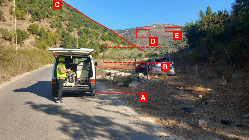
Imagery: الدفاع المدني كفرا
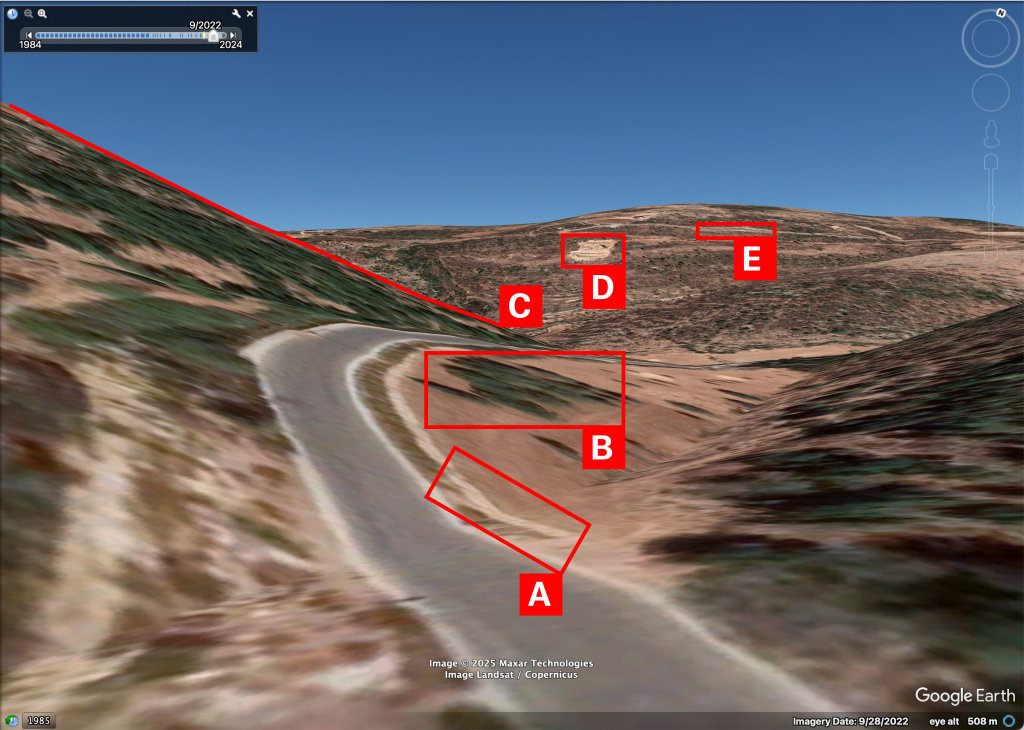
Imagery: Google Earth
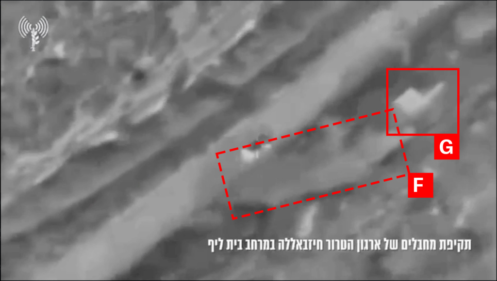
Imagery: IDF