Incident Code
Incident Date
Location
Geolocation
Geolocation
Airwars Assessment
(Previous Incident Codes: R001RS001)
Fifteen non-combatants were reported killed at the village of Za`faranah in Russia’s first wave of airstrikes in support of the Syrian regime.
According to the Syrian state-run news agency SANA, Russian warplanes targeted “ISIS dens” in al-Rastan, Talbiseh and Zafaraniya in Homs province; Al-Tilol al-Hmer, in Qunaitra province; Aydoun, a village on the outskirts of the town of Salamiya; Deer Foul, between Hama and Homs; and the outskirts of Salmiya.”
At Za`faranah, according to SN4HR, 15 civilians were killed “including two children and five women.” Following a field investigation the Violations Documentation Centre also put the death toll at fifteen.
Citing an eyewitness, VDC noted; “Two attacks were launched on the southern entrance to the village, specifically on four adjacent civilian houses.There were neither military locations nor an ISIS presence in the targeted area. Unfortunately, fourteen civilians, many unidentified, were instantly killed and more than thirty others were injured in the two strikes. Following this, at 10:00 am, warplanes targeted the area of al-Makramiah, south-west of Zaafaraneh village. As a result, a young man was killed and eight civilians were injured. On that day, the air strikes did not stop, they continued targeting the southern part of the village at about 11:00 am, causing injury to eight more people.”
Nine of the victims were named by VDC.
Russian media made no mention of civilian casualties – with TASS referring only to “pinpoint airstrikes” against what were described as ‘ISIS targets.’
Victims
Individuals
Key Information
Geolocation Notes
Reports of the incident mention an airstrike that targeted homes in an area called al-Makramiah located southwest of Za`faranah (الزعفرانية). Investigating visual material from sources, we narrowed the location of the airstrike to a block of homes on the southwest outskirts of Za’faranah. Post-strike satellite imagery also corroborates the location of the incident, for which the exact coordinates are: 34.882683, 36.770165.

Image showing general location of airstrike on Za`faranah.
Imagery: Violations Documentation Center in Syria
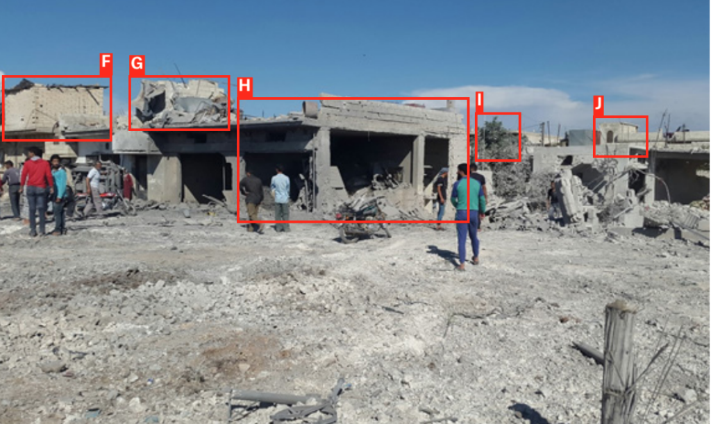
Image showing specific location of homes targeted by airstrike in Za`faranah.
Imagery: Violations Documentation Center in Syria

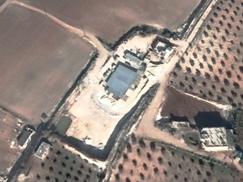
Satellite image showing features from general location of airstrike.
Imagery: Google Earth
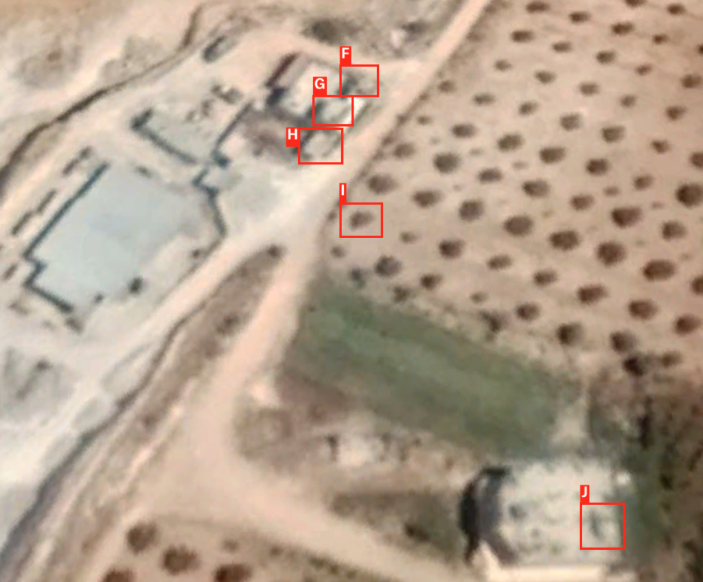
Satellite image showing features of homes targeted in airstrike.
Imagery: Google Earth
Satellite image showing undamaged home that would be destroyed in strike several months later.
Imagery: Google Earth
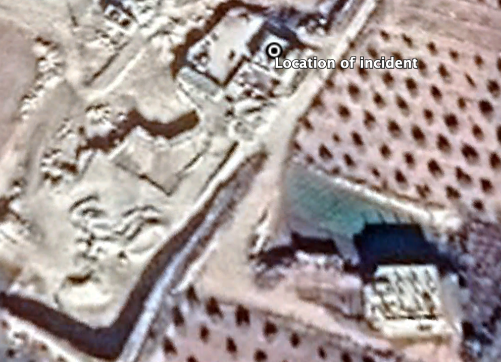
Satellite image showing damage at home targeted in airstrike several months after the incident.
Imagery: Google Earth