Incident Code
Incident Date
Location
Geolocation
Geolocation
Airwars Assessment
(Previous Incident Code: I031 )
Aircraft bombed a primary school and a hospital in the Jamhouriya neighbourhood of Fallujah, reportedly killing up to 12 civilians and injuring 9. Local media reported that children were among the dead, including 11-year old Suhaib Jassem Batawi. According to Arabi21, the attack was the work of the Iraq Air Force and had killed three schoolchildren.
However, the incident occurred during significant military action involving both the Iraq Army and Shia militia, with US airstrikes also taking place in the area, making attribution difficult.
Geolocation Notes
The alleged Coalition airstrike was reported to have struck an elementary school in the Jamhouriya neighbourhood (الجمهورية) in Fallujah (الفلوجة) in the late afternoon/evening. Satellite imagery available to Airwars of March 3, 2015 shows damage to the Jamhouriya Primary School for Boys (مدرسة الجمهورية الابتدائية للبنين), for which the coordinates are: 33.351672, 43.774166. This location was found through geolocation of the images of the school published by the Iraq Spring Media Centre. Coordinates for the midpoint of Jamhouriya neighbourhood (الجمهورية) are: 33.3536346, 43.7731147.
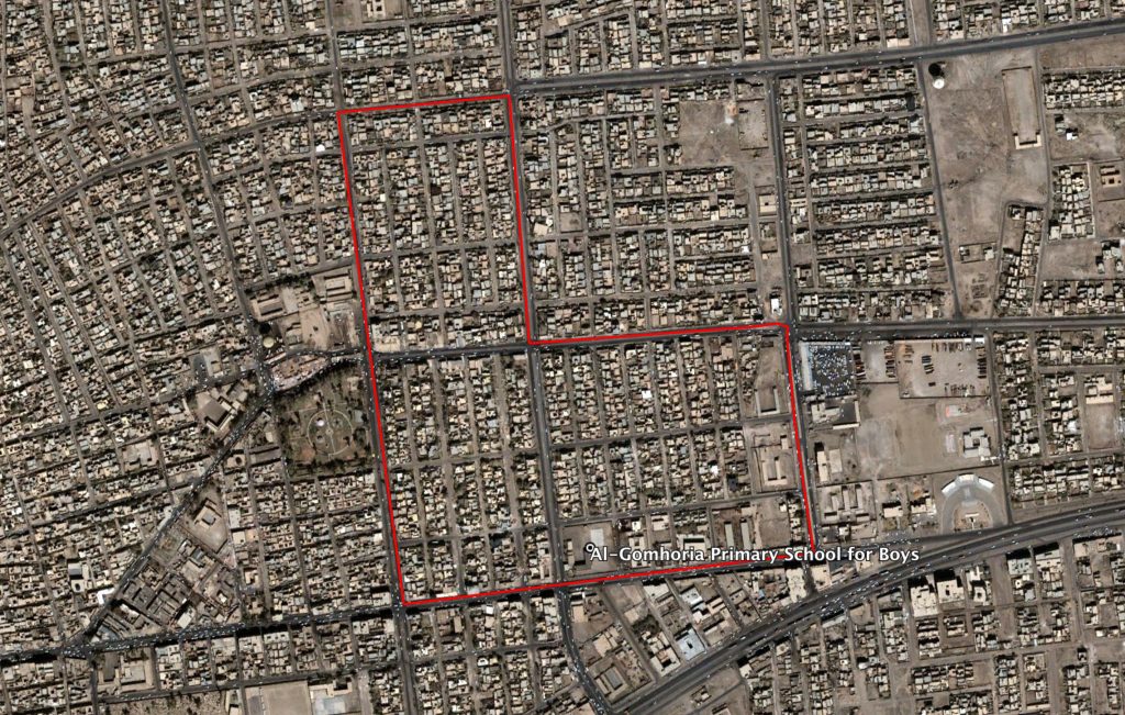
Outlines of Jamhouriya neighbourhood ( الجمهورية ) and the location of the Al-Gomhoria Primary School for Boys ( مدرسة الجمهورية الابتدائية للبنين )
Imagery: © 2018 Google
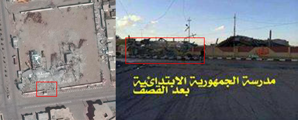
Damage visible in satellite imagery taken on Mar. 6, 2016. Features in the satellite imagery, such as the painted curb, destroyed wall and telegraph poles (shadows), match those depicted in reports of the incident. The text on the image on the right reads: "This is the Jamhouriya ( الجمهورية ) primary school after the bombing".
Date taken: March 6, 2016