Incident Code
Incident Date
Location
Geolocation
Geolocation
Airwars Assessment
(Previous Incident Code: I322 )
As many as 22 civilians were reported killed, and 29 injured, in airstrikes by an unspecified party in eastern Mosul according to local media.
Citing a local source, Shafaaq reported that five people were killed and four others wounded after an “unidentified warplane” opened fire from it’s “machine gun” in southeast Mosul.
One relative posted on Facebook that their cousin, Younis Hassan Abdullah al-Badrani was killed along with 10 family members in an aerial bombardment.
Iraqi Spring Media Center reported a total of 22 civilian deaths and 29 injuries, “mostly women and children” in Coalition airstrikes on the eastern side of Mosul.
According to Team Correspondents, the deaths occurred in “Mushayrifa, New Mosul and Hermat and Ma’moon neighborhoods.”
Buzzfeed reported in 2017 that 15 civilians died in an event at Mamun:
Neighborhood: Hay al-Mamun
GPS Coordinates: 36.310611, 43.109528
Date and approximate time: January 3, 2017, around noon
Casualties: 15 civilians, including women and children.
Comments: Another targeted strike that seems to have been either a misfire or the result of bad intelligence/surveillance. Witnesses said kids were playing on the streets outside, there were women on the rooftops. Not clear what the target would have been. I believe this was two houses set close together.”
Geolocation Notes
The news outlet, Buzzfeed, published precise coordinates for an alleged civilian casualty incident in Mamoon (المأمون) area, for which the coordinates are 36.310611, 43.109528. However, on the same day, local reports reference strikes on multiple neighbourhoods: (الموصل الجدیدة) New Mosul 36.3323266, 43.1050515, (مشیرفة) Meshrfa: 36.376753, 43.049025 and (الهرمات) Haramat: 36.3635566, 43.0702686.
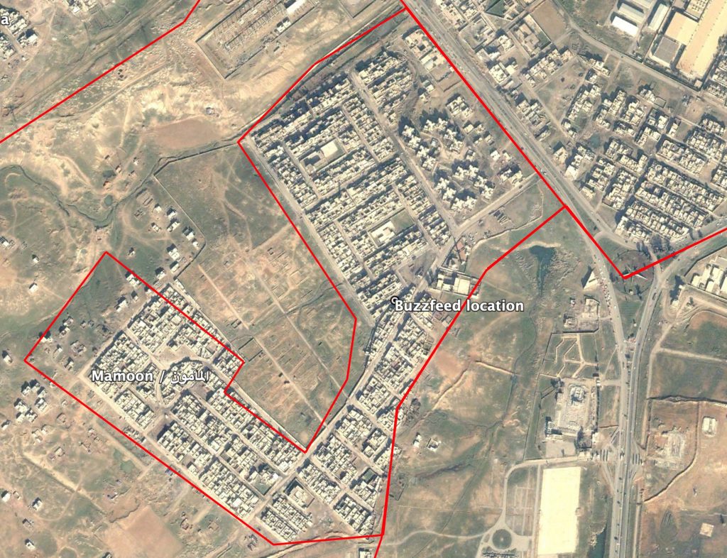
The location provided by Buzzfeed in Mamoon (المأمون) neighbourhood, Mosul.
Date taken: December 29, 2019
Imagery: © 2018 Google
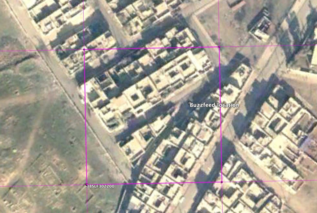
Coordinates: 36.310611, 43.109528
Date taken: December 29, 2004
Imagery: © 2018 Google