Incident Code
Incident Date
Location
Geolocation
Geolocation
Airwars Assessment
(Previous Incident Code: I436 )
Locals reported the deaths of 46 civilians including 28 children and 18 men and women with 80 others injured – mostly children and women – by different kind of shelling in many neighborhoods of Old Mosul. At least 26 bodies reportedly reached the local forensic medicine hospital.
Iraq News Center spoke of two dozen civilians killed and said that “press sources confirmed that the intelligence forces and defense ministry banned foreign journalists from entering to take pictures of dozens of bodies lying on the sidewalks and in the streets of civilian neighborhoods, who were killed in battles and clashes”.
Iraqi Spring and Correspondences team blamed the Coaition for the raids. They respectively put the death toll at 46 and 47 and reported 80 injured.
In its June 2017 report the Coalition denied responsibility: “16. March 19, 2017, near Mosul, Iraq, via social media report: The report contained insufficient information on the time, location and details to assess its credibility.”
Geolocation Notes
One source, Iraq News Center, named two neighbourhoods: New Mosul (الموصل الجدید) coordinates: 36.3323266, 43.1050515, and Al Abar (الآبار) coordinates: 36.339167, 43.096667. The areas are adjacent to each other. The report also described the incident as occurring “overnight”.
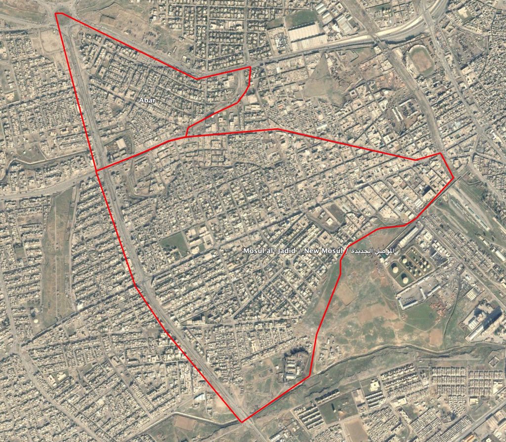
New Mosul (الموصل الجدید) and Al Abar (الآبار) neighbourhoods in West Mosul
Imagery: © 2018 Google