Incident Code
Incident Date
Location
Geolocation
Geolocation
Airwars Assessment
(Previous Incident Code: I633 )
A major civilian casualty event took place in Tal Afar district, North West of Mosul, following aerial bombardment, local media reported.
Dozens were killed according to witnesses, including entire families of mostly women and children. The local media organisation Kurdistan24 said that as many as 59 families had died in an attack it blamed on the Iraqi government. Others placed the death toll at around 70.
The activists, Omar Al Habusi and Abdulaziz Afgani, made an urgent call to international human rights organisations to expose what they described as a heinous crime. Both said that the civilians killed were displaced people, and asserted that Iraqi Government Forces were responsible.
A tweet by @AEJKHaill published graphic photographs of children killed following the raid. The source blamed the US-led Coalition and the Iraqi Army, calling it the “US-backed Iraqi Army”. @AEJKHaill described the incident as “pure terrorism”.
Geolocation Notes
Reports of the incident mention the Eyathia (العياضية) town and that survivors fled North East, towards Malha (المالحة) village. The coordinates for Eyathia (العياضية) are: 36.484214, 42.422214. The coordinates for Malha (المالحة) are: 36.518949, 42.354012. Airwars assessment summary uses the generic coordinates for Eyathia (العياضية), however, it is likely that the incident took place in the Northern outskirts of the town.
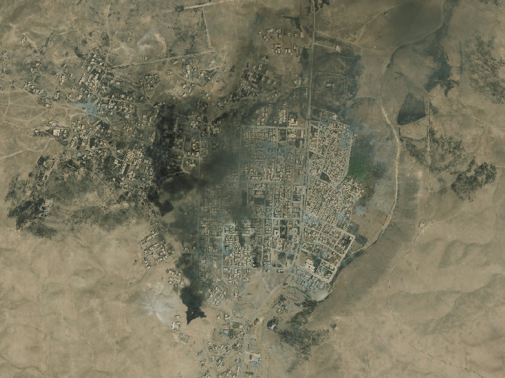
A satellite image taken on 28, August 2017, shows fires burning in West Eyathia (العياضية).