Incident Code
Incident Date
Location
Geolocation
Geolocation
Airwars Assessment
(Previous Incident Code: I654a)
According to two local sources, some civilians killed following an alleged Coalition airstrike targeted the residential neighbourhoods in Huwaija.
Al Rafdain said that a number of civilians were killed and others wounded in an aerial bombardment, with a press source reportedly adding that aircraft bombed three sites in the Sina’iya area in Hawija, resulting in deaths and injuries in addition to causing damage and destruction of homes and property of citizens.
Later the Coalition published the report: September 19, 2017, near al-Hawijah, Iraq, via Airwars report. After a review of available information, it was assessed that no Coalition strikes were conducted in the geographical area that corresponds to the report of civilian casualties.
Key Information
Geolocation Notes
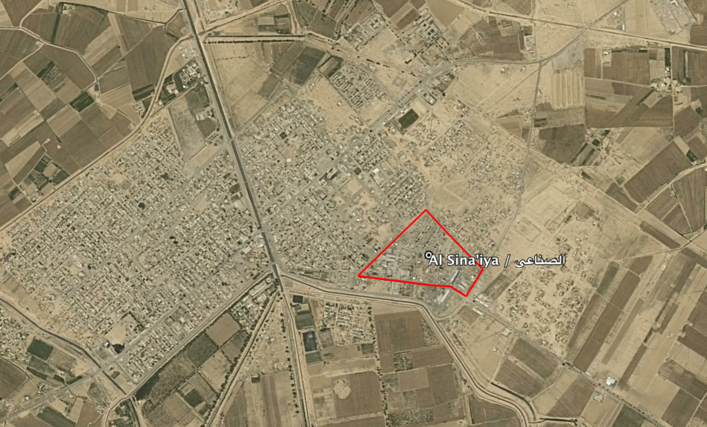
Reports of the incident mention the Industrial neighbourhood, or Al Sina’iya (الصناعي) in the town of Hawija (حویجة). The generic coordinates for this neighbourhood are: 35.321848, 43.785152.

The neighbourhood of Al Sina'iya (الصناعي) in the town of Hawija
Imagery: © 2019 Google
