Incident Code
Incident Date
Location
Geolocation
Geolocation
Airwars Assessment
(Previous Incident Codes: R1024 RS1134 )
Between five and nine civilians were killed, including children, and between 10 and 15 more were injured from two air raids that targeted the town of Tal Adeh in the Idlib countryside.
Baladi News published a video depicting volunteers searching the rubble for survivors of the airstrikes.
Local sources were conflicted as to who was responsible for the airstrikes. Russian warplanes were identified as responsible by Syria Newsdesk and Syrian Human Rights Committee. However, SPC and @EdlibEMC blamed regime jets.
Geolocation Notes
Reports of the incident mention the village of Tal Adeh (تلعادة). Analysing audio-visual material from sources, we have narrowed down the location to these exact coordinates: 36.252778, 36.803283.
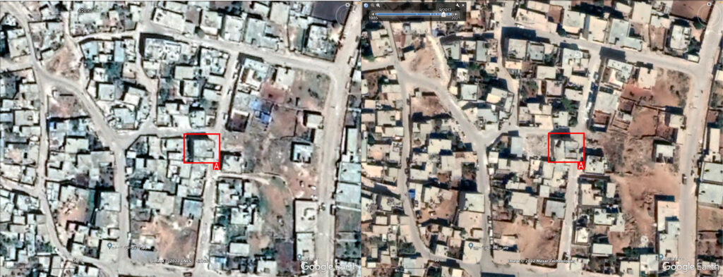
Left: satellite imagery taken before the incident (April 2016). Right: satellite imagery taken after the incident (September 2017).
Imagery: Google Earth Pro
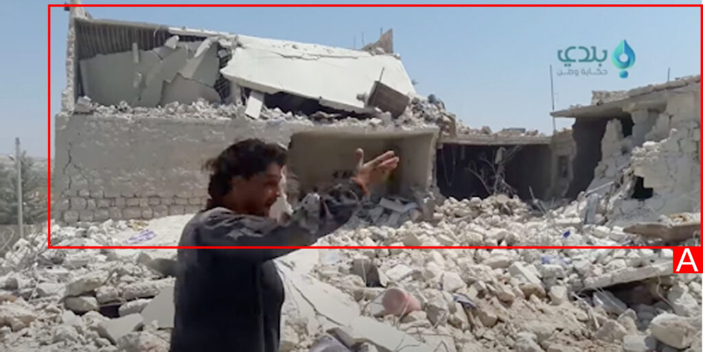
Date taken: August 12, 2016
Imagery: https://www.youtube.com/watch?v=7HL4s3imbAQ