Incident Code
TS391
Incident Date
10 November 2019
Location
Sharakrak Silos, Raqqa, Syria
صوامع شركراك
Geolocation
36.417648,
38.956206
Accuracy: Exact location (via Airwars)
Geolocation
36.417648,
38.956206
Accuracy: Exact location (via Airwars)
Airwars Assessment
Last Updated: December 15, 2024
Two civilians were reported injured as a result of alleged Turkish forces shelling on the villages of Sharqê and Sawama close to the M4 highway and the town of Shelgirat in Eyn Isa, Raqqa governorate in Syria on November 11th, 2019 according to local sources.
The strikes reportedly hit grain silos.
Geolocation Notes
Reports of the incident mention the silos of Sharakrak (صوامع شركراك) being struck, west of the village of Sharakrak (شركراك), for which the exact coordinates are: 36.417648, 38.956206.
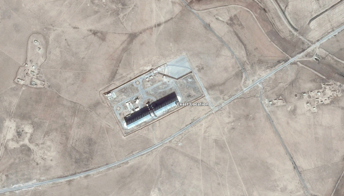
Exact location of the strike on the silos of Sharakrak (صوامع شركراك), west of the village of Sharakrak (شركراك).
Imagery: Google Earth
Military Statements
Turkish Military Assessment
Suspected belligerent
Turkish Military
Turkish Military position on incident
Not yet assessed