Incident Code
Incident Date
Location
Geolocation
Geolocation
Airwars Assessment
Deaths and injuries among civilians were reported by local sources as a result of alleged Turkish forces and Turkey-backed militants shelling of Ain Issa, in Raqqa, Syria on August 17th, 2020.
While most sources reported that two civilians were wounded, others reported deaths without a specific number.
@dersi4m tweeted that ‘theTurkish army and it’s jihadist groups shelled this evening the villages Abu Sira, Dibis and the surrounding of the Highway M4 in western of Ain Issa town.Two civilians have been wounded (ANHA).’
@RojavaSiyamend said that ‘Turkish forces bombard Ain Issa town areas with heavy weapons, directly targeting civilians. There are wounded and dead.’
No further information is available yet.
Geolocation Notes
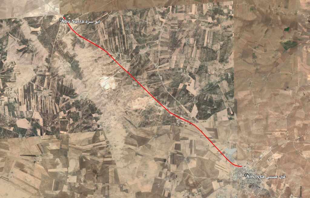
Reports of the incident mention areas being struck along the M4 highway, among them Abu Surra (ابو سيرا) and Dibis, in the western vicinity of Ain Issa (عين عيسى) town. Due to limited satellite imagery and information available to Airwars, we were unable to verify the location further. The generic coordinates for Ain Issa are: 36.385278, 38.859444.
Reports of the incident mention areas being struck along the M4 highway, among them Abu Surra (ابو سيرا) and Dibis, in the western vicinity of Ain Issa (عين عيسى) town.
Imagery: Google Earth