Incident Code
Incident Date
Location
Geolocation
Geolocation
Airwars Assessment
(Previous Incident Code: I024a)
According to a single source, local eyewitness claimed one unnamed civilian was killed and five others were severely injured after the coalition allegedly bombed several areas in Makhmoor, south of Mosul
Key Information
Geolocation Notes
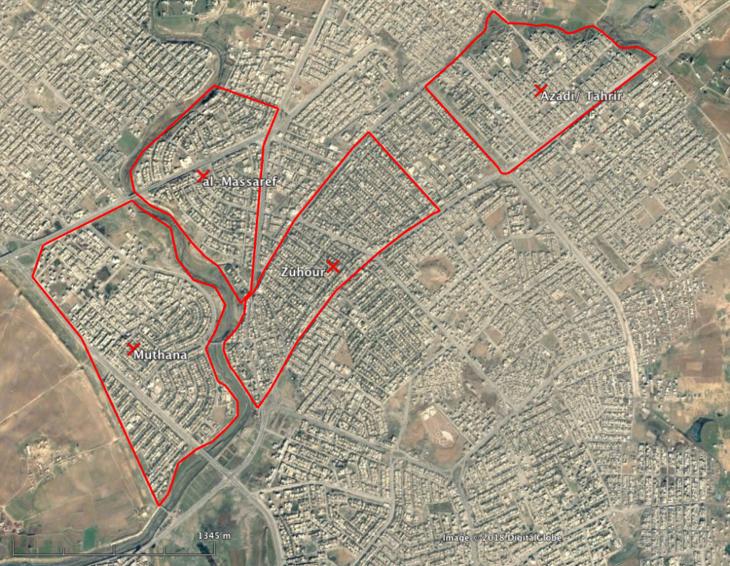
Reports of the incident mention several neighbourhoods located in Mosul: al-Zohour (حي الزهور), coordinates: 36.3789337, 43.1850243; al-Bunook/al-Massaref (المصارف), coordinates: 36.383915, 43.175855; al-Muthanna (حي المثنى), coordinates: 36.3738889, 43.1718063; al-Tahrir (تحرير), coordinates: 36.389470, 43.202222. Reports do not identify which strike occured in which neighbourhood. This is most likely because al-Zohour, al-Massaref and al-Muthanna, are adjacent, covering a area of only 4 square km

al-Zohour ( حي الزهور ), al-Massaref ( المصارف ), al-Muthanna ( حي المثنى ), al-Tahrir ( تحرير )
Imagery: © 2018 Google
