Incident Code
Incident Date
Location
Geolocation
Geolocation
Airwars Assessment
(Previous Incident Code: I210)
A local source said 20 civilians were killed or injured along with three Daesh fighters after Coalition jets allegedly targeted four neighbourhoods in central Mosul.
A single source, Yaqein, said the strikes took place in the evening. Among those targeted was a Daesh ’emir’ from Morocco, whose white Hyundai was destroyed. But civilian casualties were also said to be high. According to local sources, “corpses littered the streets and remained for more than an hour for fear of further bombing until an ambulance finally came.“
In the first of their March 2020 civilian casualty reports, the US-led Coalition assessed reports that they were responsible for civilian harm in these strikes as “non-credible”, stating that no Coalition actions were conducted in the geographical area at that time.
Key Information
Geolocation Notes
Reports of the incident mention multiple neighbourhoods in the east of Mosul: Sumer (سومر), for which the coordinates are: 36.2981099, 43.2000446; Arabi (العربي), for which the coordinates are: 36.411958, 43.1138706; and Zuhour (الزهور), for which the coordinates are: 36.3789337, 43.1850243. Due to limited satellite imagery and information available to Airwars, we were unable to verify the location further.
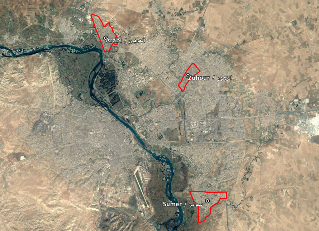
The neighbourhoods of Sumer (سومر), Arabi (العربي) and Zuhour (الزهور) in the city of Mosul
Imagery: © 2019 Google