Incident Code
Incident Date
Location
Geolocation
Geolocation
Airwars Assessment
(Previous Incident Code: I352)
Local sources said heavy artillery shelling which targeted Al Arabi neighbourhood at the left side of Mosul had left dozens of civilians dead or wounded.
In October 2020, the US-led Coalition conceded killing 12 civilians and injuring a further ten in this event.
Iraqyoon said at the time that witnesses had reported to the Iraqi news agency that “the near-Khashab mosque area in the north of the Al Arabi neighborhood of Mosul came under artillery shelling by Iraqi forces.”
Nineveh Media Center reported that a clinic in the neighbourhood had also been targeted. It spoke of heavy, unidentified shelling.
In earlier monthly civilian casualty reports, the US-led Coalition had indicated that the credibility of this civilian harm allegation was in the process of being assessed. On October 29th 2020, officials confirmed the incident, noting: “Jan. 12, 2017, in Mosul, Iraq, via Airwars report. Coalition aircraft conducted an airstrike against a Daesh facility. Regrettably, twelve civilians were unintentionally killed and ten were unintentionally wounded as a result of the strike.”
Key Information
Geolocation Notes
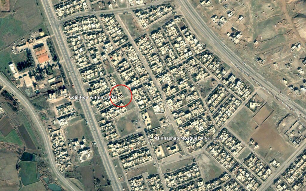
Reports of the incident mention a strike within the vicinity of Al Khashab Mosque (جامع الخشاب), at the coordinates: 36.402348, 43.118259. Coalition has confirmed the location of this strike (within 100m), north of Al Khashab Mosque at the following coordinates: 36.40393, 43.11644.

Reports of the incident mention a strike within the vicinity of Al Khashab Mosque (جامع الخشاب). Coalition has confirmed the location of this strike (within 100m), north of Al Khashab Mosque.
Imagery: Google Earth
