Incident Code
Incident Date
Location
Geolocation
Geolocation
Airwars Assessment
(Previous Incident Code: I423)
A single source reported that dozens of civilians were killed or injured during the last two days due to different types of shelling in downtown/central Mosul. It was reported that many of the injured had no access to medical treatment and that people were unable to leave their homes, which were damaged by the bombings.
Key Information
Geolocation Notes
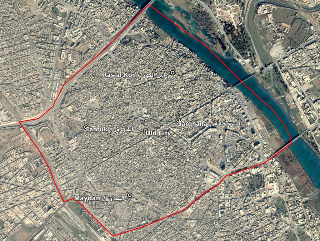
The incident report mentions multiple neighbourhoods in old Mosul but does not identify where the casualties occurred. The coordinates for the neighbourhoods are as follows: Sarqhana (السرجخانة) midpoint 36.342500, 43.130556; Farouk (الفاروق) midpoint 36.3431411, 43.1257262; Maydan (المیدان) midpoint: 36.335556, 43.125; Ras al Kor (راس الكور) midpoint: 36.3468977, 43.129921. Airwars’ assessment uses the generic coordinates for Old Mosul.
Old Mosul, including Maydan (الميدان)
Imagery: © 2018 Google