Incident Code
Incident Date
Location
Geolocation
Geolocation
Airwars Assessment
(Previous Incident Code: I435)
At least thirteen civilians were reported killed and 17 injured in air and artillery strikes on a number of West Mosul neighbourhoods.
Iraqi Spring Media Centre said reported the “Killing of 13 civilians, mostly women and children, and 17 wounded as a result of air and artillery bombardments of several districts of the right side of Mosul on Saturday.”
In what may have been a related event, Yaqein said that 29 civilians died at Jawasaq when it was bombarded by Iraqi forces.
Al Jazeera reported that “15 people from the same family were killed when a rocket hit their house in Serjkhana area, which is located in the old centre of Mosul, the western side of Mosul, on Saturday afternoon. The sources added that the rocket led to the destruction of the entire house and killing everyone who was in it, mostly women and children, as well as events of major damage to the neighbouring houses in which many families were located.” This may also be a separate incident.
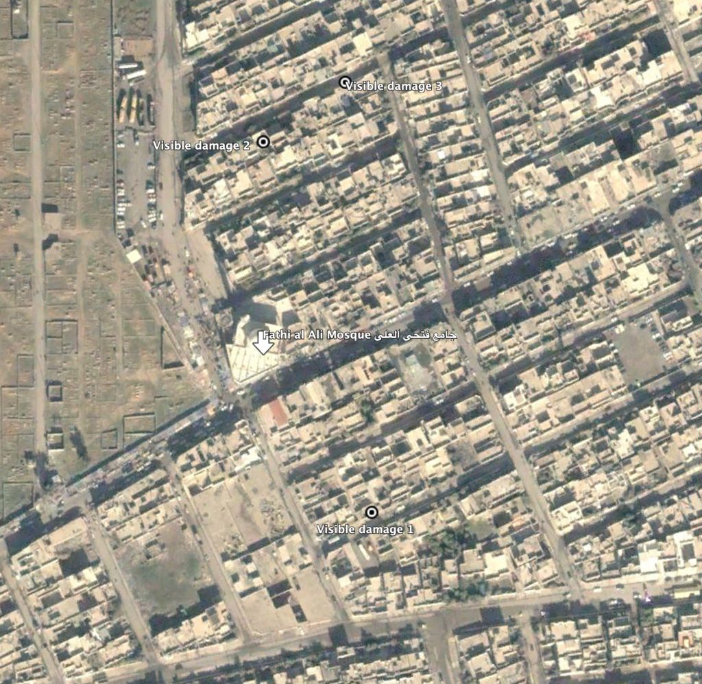
The New Mosul People Facebook page received an appeal from local residents (see below), saying: “Families were bombed by a plane an hour ago and about 50 persons were killed. My family and kids shouting under the rubble, in the third street behind Fathi Al Ali mosque [in Aserjkhanh neigbourhood], a neighbour of barber Mahmood Abu Arkan, we ask to save them from under the rubble, Mohammed Ganim Aub Al Muhazam and Jassim Ameen Aub Al Mahzam families.” It did not say who carried out the raids.
Key Information
Geolocation Notes
Reports of the incident mention the third street behind Fathi Al Ali mosque (جامع فتحي العلي), in Aserjkhanh neighbourhood. The coordinates for the mosque are: 36.328265, 43.093492. The strike likely within a 500 meters radius from the mosque. Visible damage to residential houses, three streets away from the mosque to the North and South is visible in satellite imagery: 36.327386, 43.094257; 36.329476, 43.093497; 36.329812, 43.094071. Airwars was able to access satellite images taken on March 8 and March 25, bridging a 17-day window. For this reason, we are unable to determine which these three locations, if any of them, is where the March 18 report incident occurred.
Date taken: December 29, 2004
Imagery: © 2018 Google