Incident Code
Incident Date
Location
Geolocation
Geolocation
Airwars Assessment
(Previous Incident Code: I511)
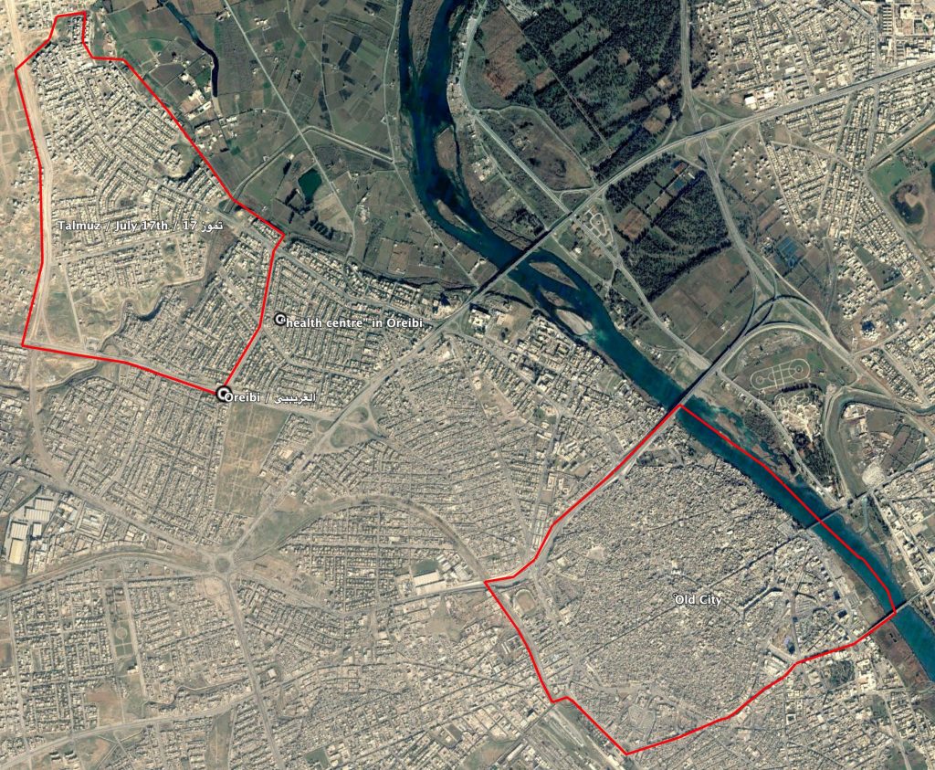
Local sources reported that 59 civilians, including women and children, were killed and dozens were injured after Coalition airstrikes and shelling on 17 July neighbourhood, as well as on Old Mosul and a health centre in Oreibi neighbourhood, all in West Mosul. It was said that more than seven houses were destroyed “over the heads of residents”.
Key Information
Geolocation Notes
Reports of the incident refer to residential buildings in the 17 July (تموز 17), as well as Old Mosul (المدینة القدیمة) and a “health centre” (مركز صحي) in the Oreibi area (العریبیي). For this reason, the coordinates given in the assessment summary are the generic coordinates for West Mosul. The coordinates for 17 July (Talmuz/تموز 17 ) are 36.3667014, 43.0854607. The coordinates for Oreibi (العریبیي) are 36.3539142, 43.0924988, although its boundary are unclear. Possible coordinates for the “health centre” in Oreibi (مركز صحي في حي العریبي) are 36.3584776, 43.0967943.
Locations named in reports of the incident.