Incident Code
CI822
Incident Date
4 August 2017
Location
العباسية, Al Abbasiyah, Kirkuk, Iraq
Geolocation
34.27702,
43.80145
Accuracy: Village
Geolocation
34.27702,
43.80145
Accuracy: Village
Airwars Assessment
Last Updated: December 15, 2024
(Previous Incident Code: I621)
According to a local report, civilians were killed followed airstrikes on Salah ad Din Province.
Yaqein reported that a number of civilians were killed as a result of ongoing attacks by government forces and international coalition aircraft. The report also cited militias fighting in the area and said that indiscriminate and heavy shelling had killed dozens of civilians.
No additional details are presently known.
Key Information
Country
Military Actor
Civilian Harm Reported
Yes
Civilian Harm Status
Contested
Civilians reported killed
2
Geolocation Notes
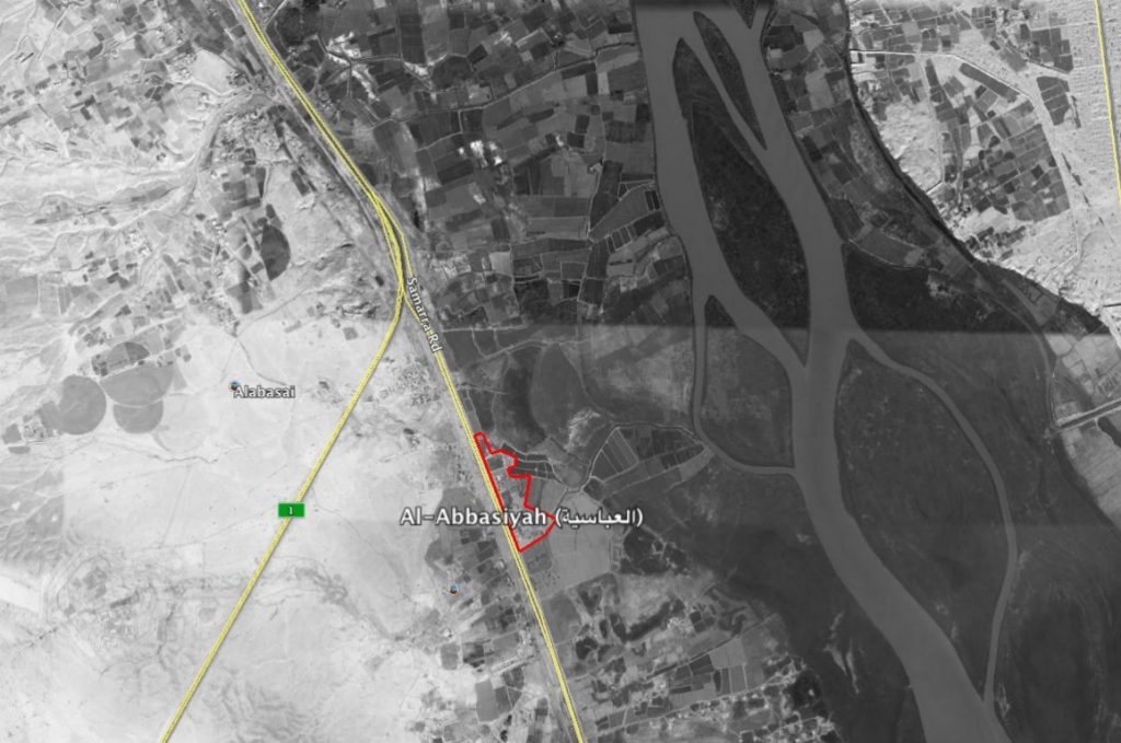
Reports of the incident mention the town of Al Abbasiyah (العباسية), southwest Kirkuk governorate, for which the coordinates are: 34.27702, 43.80145

The village of Al-Abbasiyah (العباسية)
Imagery: © 2018 Google
Military Statements
U.S.-led Coalition Assessment
Suspected belligerent
U.S.-led Coalition
U.S.-led Coalition position on incident
Non credible / Unsubstantiated
Reason for non-credible assessment
No Coalition strikes were conducted in the geographical area
Civilian deaths conceded
None
Civilian injuries conceded
None
Stated location
near al Abbasiyah, Salah al-Din, Iraq
U.S.-led Coalition Strike Report
For August 3rd – 4th, the Coalition reported: “Near Kirkuk, one strike engaged an ISIS tactical unit.” For August 4th – 5th, the Coalition reported: “Near Al Huwayjah, two strikes destroyed an ISIS-held building and an ISIS headquarters.”
U.S.-led Coalition Civilian Casualty Statement
2018-05-31
Original Source ↗
After a review of available information it was assessed that no Coalition strikes were conducted in the geographical area that correspond to the report of civilian casualties.
Iraq Government Forces Assessment
Suspected belligerent
Iraq Government Forces
Iraq Government Forces position on incident
Not yet assessed
