Civilian Casualties

Civilian Casualties

Incident Code

ISPT0126

Incident date

October 11, 2023

Location

قرب أبراج الكرامة, Vicinity of Al Karama Towers, Gaza, the Gaza Strip

Geolocation

31.544161, 34.466389 Note: The accuracy of this location is to Nearby landmark level. Continue to map

Airwars assessment

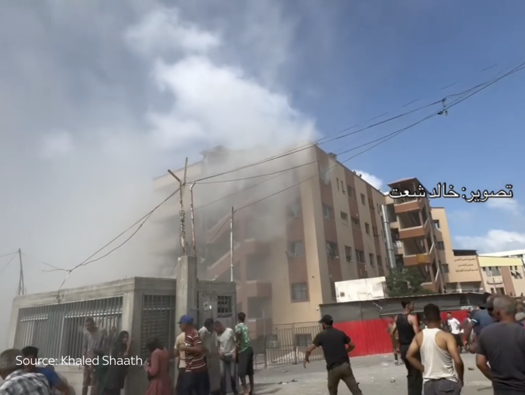
On October 11, 2023, two civilians were reportedly killed and two paramedics injured when an ambulance evacuating injured people near to Al Karama Towers was struck by alleged Israeli strikes. Sources did not provide the names or identities of the victims.

A report published by Al Mezan Center for Human Rights claimed that a number of strikes had hit the Karama neighbourhood from Tuesday 10th October onwards. The strikes were allegedly attributed to the Israeli forces by @HAMADBANALI1 and Al Mezan report. Mezan’s report stated a large number of injured were still under the rubble while strikes continued.

Al-Mayadeen’s correspondent in Gaza reported the attack on the ambulance, as well as other news agencies such as Shehab and AJA Egypt.

Due to the scale and urgency of Airwars’ assessment process, all images have been automatically uploaded to each assessment with the graphic filter applied to protect users. We have also included all images identified from the sources, which may also include any imagery of combatants.

The local time of the incident is unknown.

Summary

  • Strike status
    Likely strike
  • Strike type
    Airstrike
  • Civilian infrastructure
    Healthcare facility
  • Civilian harm reported
    Yes
  • Civilians reported killed
    2
  • Civilians reported injured
    2
  • Cause of injury / death
    Heavy weapons and explosive munitions
  • Airwars civilian harm grading
    Fair
    Reported by two or more credible sources, with likely or confirmed near actions by a belligerent.
  • Impact
    Healthcare
    Impact on services or infrastructure relating to education, health or food supply. See methodology note for details.
  • Suspected attacker
    Israeli Military

Sources (6) [ collapse]

Geolocation notes

Reports of the incident mention the vicinity of Al Karama Towers (قرب أبراج الكرامة), for which the generic coordinates are: 31.544161, 34.466389. Due to limited satellite imagery and information available to Airwars, we were unable to verify the location further.

Israeli Military Assessment:

  • Suspected belligerent
    Israeli Military
  • Israeli Military position on incident
    Not yet assessed

Summary

  • Strike status
    Likely strike
  • Strike type
    Airstrike
  • Civilian infrastructure
    Healthcare facility
  • Civilian harm reported
    Yes
  • Civilians reported killed
    2
  • Civilians reported injured
    2
  • Cause of injury / death
    Heavy weapons and explosive munitions
  • Airwars civilian harm grading
    Fair
    Reported by two or more credible sources, with likely or confirmed near actions by a belligerent.
  • Impact
    Healthcare
    Impact on services or infrastructure relating to education, health or food supply. See methodology note for details.
  • Suspected attacker
    Israeli Military

Sources (6) [ collapse]