Incident Code
Incident Date
Location
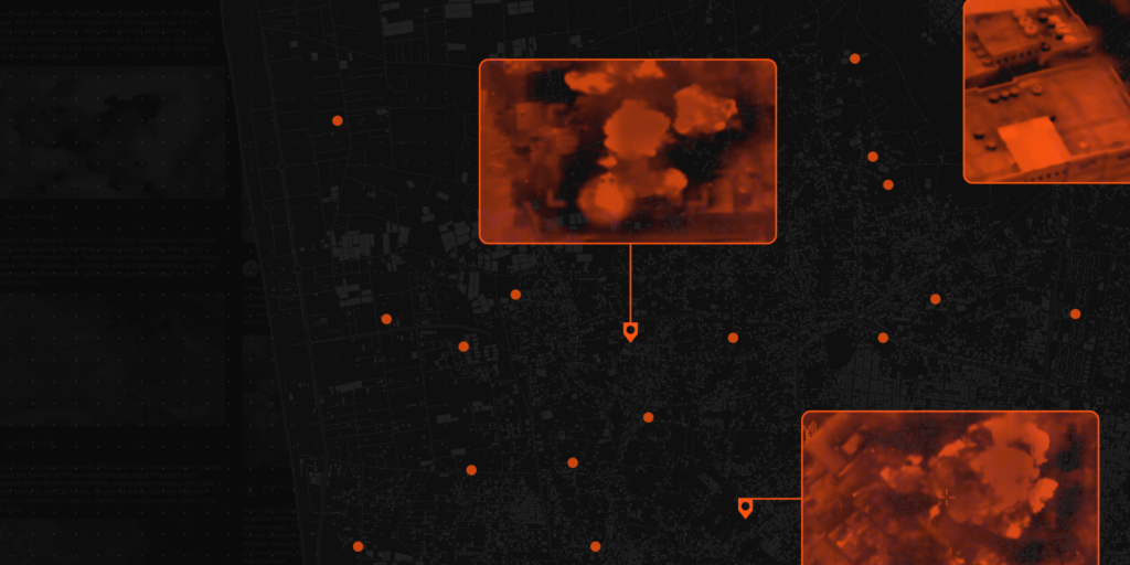
Geolocation
Geolocation
Airwars Assessment
On the afternoon of Wednesday, October 18th 2023, several children were reportedly killed and injured when an alleged Israeli airstrike hit the Hammad family home in the Al-Alami neighbourhood in the Jabalia camp, in the north of the Gaza Strip. The precise number of victims remains unknown and the victims have not yet been identified.
On October 18th 2023, the Information Office of the Palestinian Ministry of the Interior and National Security reported on X/Twitter that the Hamad family home had been destroyed and a number of children had been killed in an incident that afternoon.
Many sources reported this incident including the Palestinian news agency Safa and the Palestinian Ministry of the Interior. Almost all sources repeated the same quote from the original post by the Palestinian Ministry of the Interior, with the exception of Al-Weeaam News Agency which used different language when it reported the incident on its website. In line with Airwars methodology, the civilian harm status of this incident has been assessed to be “Fair” because more than one source reported the incident with sufficiently different information. Three sources, Abdulrahman al Abaldeh, the Palestinian Ministry of the Interior and the Palestinian Information Centre posted multiple different photos of the incident on Facebook and X/Twitter.
On October 9th, 2024 the Airwars Investigations Unit, along with Sky News, published an investigation geolocating and matching airstrike footage released by the Israeli military with incidents in the Airwars archive. In total, Airwars’ team identified 17 strikes leading to civilian harm from the first month of the war, of which the Israeli military itself had published footage. This strike was among the 17. As such this incident has been reclassified as a declared Israeli strike, rather than a likely one.
Several news outlets and journalists shared images depicting Emergency Medical Services pulling up severely injured children from beneath the rubble. One image depicted the acute infrastructural damage caused by the attack, which completely collapsed the multi story building.
@aa_arabic shared a video on X/Twitter of Emergency Medical teams rushing dust covered children from an ambulance into a crowded hospital to receive treatment. The comment read “A new massacre in #Khan Yunis against the Hammad family, the majority of whom are children”. This source may not have referred to this incident as it described the incident taking place in Khan Yunis, which is a city in the southern Gaza Strip.
All sources reference “a number” of people were killed, “a majority” of whom were children; but the precise number is unclear. Images of the incident posted on X/Twitter and Facebook by Abdulrahman al Abaldeh, the Palestinian Ministry of the Interior and the Palestinian Information Centre show at least three different children who had been harmed.
Both the Palestinian Ministry of the Interior and Al-Waaeem news agency reported that the incident was caused by an Israeli Military aircraft.
Assessment Updates
Geolocation Notes
Reports of the incident mention the al Alami neighborhood (العلمي) in Jabalia (جباليا). Analysing audio-visual material from sources, we have narrowed the location down to the following exact coordinates: 31.537166, 34.500485. The Airwars team matched these exact coordinates to a screenshot taken at 0:10 of the strike video shared by the IDF to Twitter/X (see strike reports below).
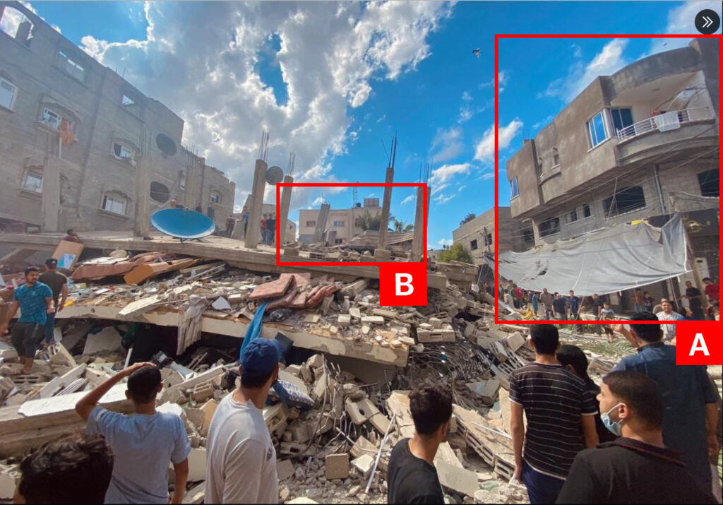
Imagery: @PalinfoAr
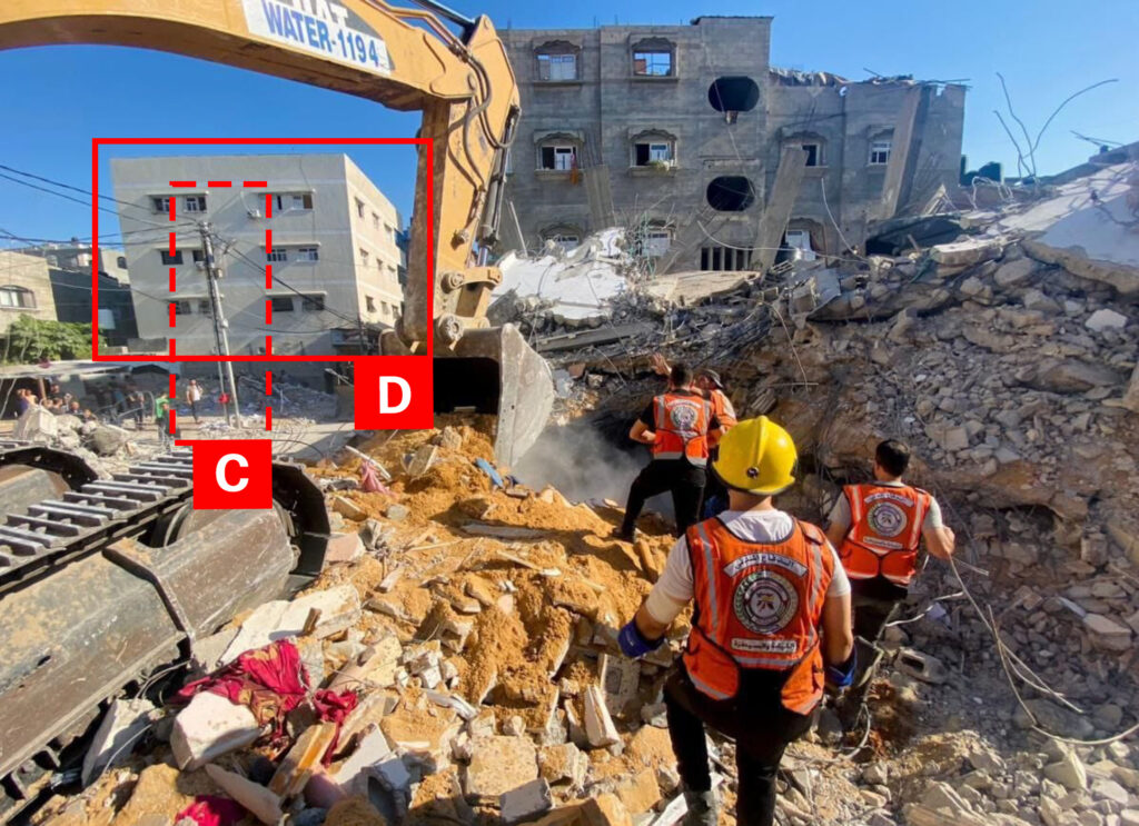
Imagery: @PalinfoAr
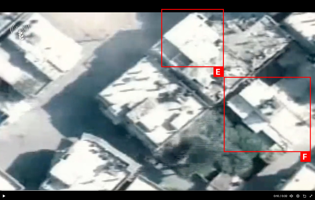
Imagery: IAFsite