Incident Code

ISPT0556

Location

حي الأمل، خانيونس, Al-Amal neighborhood, Khan Younis, Khan Younis, Palestinian territories

Geolocation

31.352908, 34.297651
Accuracy: Exact location (via Airwars)

Airwars Assessment

Last Updated: January 28, 2025

On Tuesday, October 24th, 2023, an Israeli aircraft allegedly bombed a house for the Al-Nawajah family in the Al-Amal neighbourhood in Khan Younis. According to reports, three civilians were killed, and between 10 and 16 others were injured in the attack. No further information regarding identification has been made public.

The house, across the street from the Al-Hilal Hospital and near to both the Red Crescent headquarters and Al-Rahma mosque, appeared completely demolished. Images of civilians and Red Crescent volunteers searching the rubble for casualties were shared by Twitter/X user @myreturnnet. One image shows a man carrying two children away from the scene, apparently unharmed. Another photograph, shared by user @DabeCerocool001, shows four men carrying an injured man from his limbs.

Both Shehab Agency and Palinfo News reported that three people were killed, but did not include specifics. Many other sources reported that 15 had been injured, with one source @hamza198708 claiming 16 had been wounded. Facebook user Basma al-Farra reported all casualties were taken to the Nasser Hospital.

Where sources identified the belligerent, all sources attributed the strikes to Israeli forces.

Key Information

Military Actor
Strike Type
Airstrike
Strike Status
Likely strike
Civilian Harm Reported
Yes
Civilian Harm Status
Fair
Reported by two or more credible sources, with likely or confirmed near actions by a belligerent.
Causes of Death / Injury
Heavy weapons and explosive munitions
Civilians reported killed
3
Civilians reported injured
10–16
1 Man

Geolocation Notes

Reports of the incident mention a residential building being struck in the Al-Amal neighbourhood (حي الأمل) in Khan Younis (خانيونس). Analysing audio-visual material from sources, we have narrowed the location down to the following exact coordinates: 31.352908, 34.297651.

{"type":"FeatureCollection","features":[{"type":"Feature","properties":{"label":"Exact Location","label-type":"black-white"},"geometry":{"coordinates":[34.297627730180665,31.35297965470103],"type":"Point"}},{"type":"Feature","properties":{"label":"A","label-type":"white-red","stroke":"#ff0000","stroke-width":1,"stroke-opacity":1,"fill-opacity":0},"geometry":{"coordinates":[[[34.29774409844512,31.35237357187239],[34.29767145333855,31.352292412902827],[34.29791788315339,31.35213670075902],[34.29798860740158,31.352218803573635],[34.29774409844512,31.35237357187239]]],"type":"Polygon"}},{"type":"Feature","properties":{"label":"B","label-type":"white-red","stroke":"#ff0000","stroke-width":1,"stroke-opacity":1,"fill-opacity":0},"geometry":{"coordinates":[[[34.297953945701295,31.35294104310637],[34.297808030567325,31.35276923442916],[34.29792852109401,31.35269371403281],[34.29807664706277,31.352866466850784],[34.297953945701295,31.35294104310637]]],"type":"Polygon"}}]}

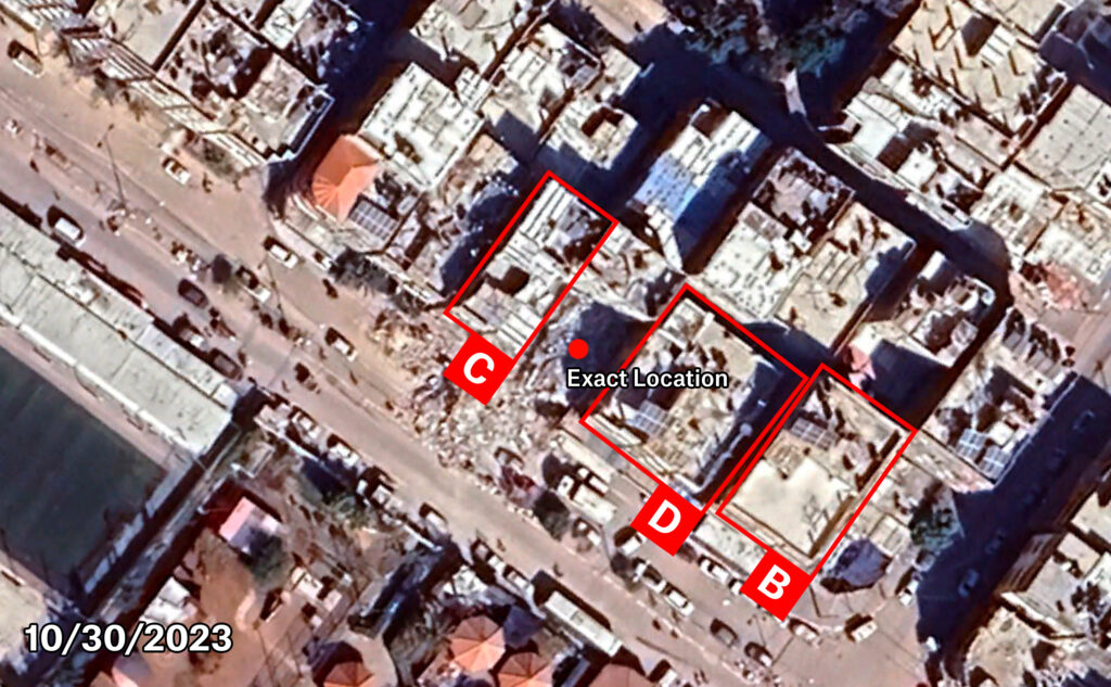
Imagery: Google Earth

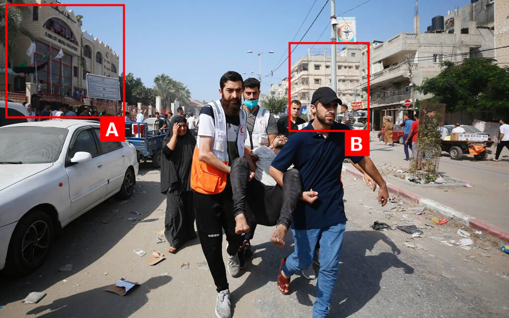
Imagery: @DabeCerocool001

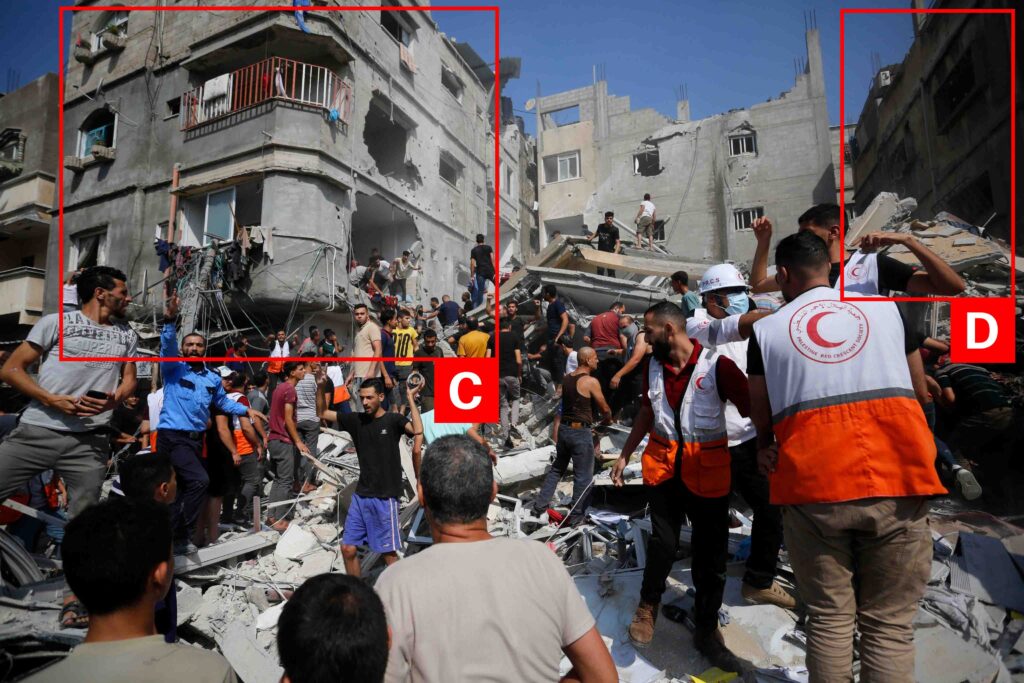
Imagery: @myreturnnet

Military Statements

Israeli Military Assessment
Suspected belligerent
Israeli Military
Israeli Military position on incident
Not yet assessed

Media From Sources (10)