Incident Code
Incident Date
Location
Geolocation
Geolocation
Airwars Assessment
During the morning of May 29th, at least three people were injured when members of the Israeli military reportedly “opened fire” in the Al-Alam area, near the “American aid distribution center” in Rafah.
Shehab News Agency was among the first to report on the injuries, posting at 5:51 AM. Within an hour of this first post by the Shehab Agency, other sources, namely Talal Abu Hussein, Hamla Kaddour, and Mohamad Fathy Alsharif on Facebook, as well as Shaabradio on Twitter/X reported the same.
At around 2 PM on the 29th, an account called Media News, posting to Facebook, shared a video with the caption “The moment of direct shooting at citizens in the Mawasi area of Rafah, south of the Gaza Strip.”
The video shared by Media News is broken into two shorter clips. The first is shot partially from behind a tent, showing a raised space dotted with tents. A large mosque is also in view, and the inscription on the mosque suggests it is called the Mu’awiyah Mosque. Ten to twenty people are seen running from the general direction of the mosque, and the videographer says that there is heavy gunfire directly on citizens. At the end of the vignette, gunshots are heard and the crowd, which includes children, duck.
The second vignette shows a crowd around an ambulance, and a man being transferred from one vehicle to the next. In the video, his foot is bandaged and bloody.
An image shared to Facebook by user Hamla Kaddour showed a plume of smoke rising from behind a building. As it does not appear that this image was connected to the incident reported on, it has been removed from the assessment.
Where sources identified the belligerent, all sources attributed the responsibility to the Israeli military.
Geolocation indicates GHF proximity.
Assessment Updates
Geolocation Notes
Reports of the incident mention the vicinity of Al-Alam roundabout (دوار العلم) in Mawasi (المواصي). Due to limited satellite imagery and information available to Airwars, we were unable to identify the location of the Distribution Center referenced in the sources. The generic coordinates for Al-Alam roundabout are: 31.331282, 34.230225.
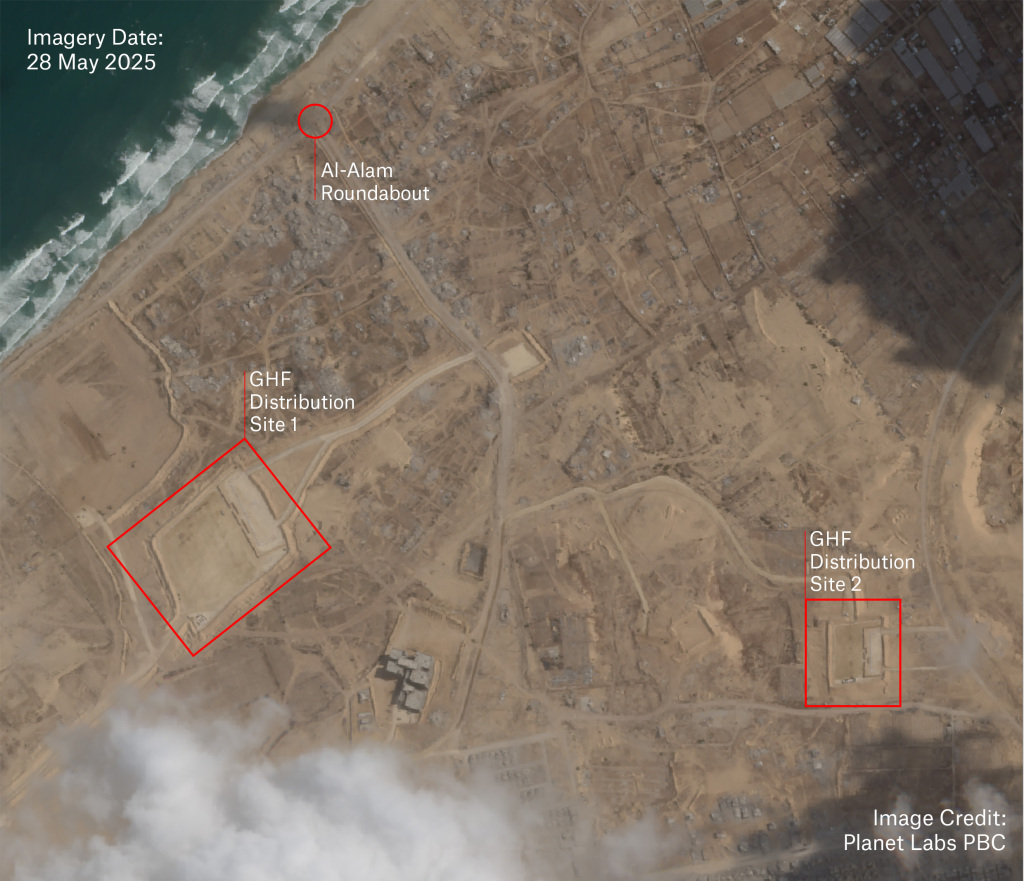
Imagery: Planet Labs PBC