Incident Code
Incident Date
Location
Geolocation
Geolocation
Airwars Assessment
(Previous Incident Codes: R167aRS192)
According to Zaitonmag, Russian aircraft carried out a raid on Sarmada on the Turkish border, “targeting a garage of relief trucks which has led to anonymous martyrs and two people slightly injured.“
The Syrian Network also reported the event, saying the attack by warplanes destroyed eight trucks and a water tank and killed one person. It also cited ‘Shareef’, a media activist from the town: “The shelling targeted a civilian area on the international highway between Sarmada and Bab Al Hawa crossing point where there were a group of fuel stations, warehouses and freight vehicles. Russian warplanes launched the airstrike, and I was able to differentiate it from the Syrian shelling.”
Key Information
Geolocation Notes
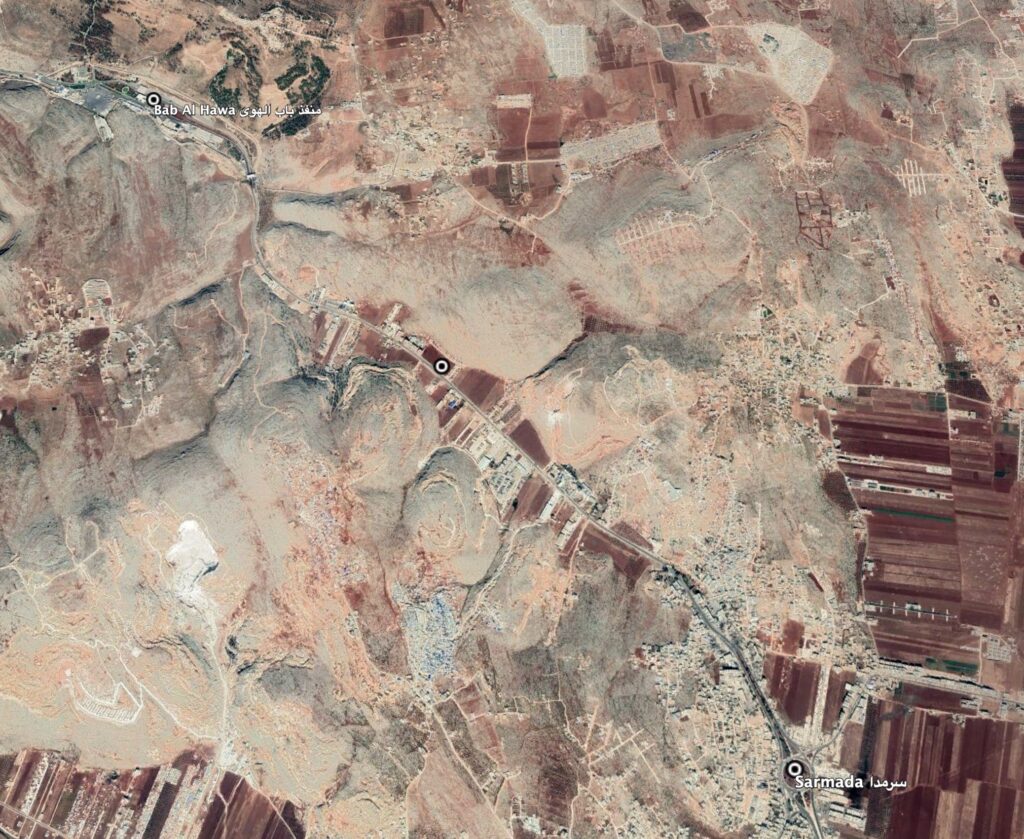
Reports of the incident mention that the strike hit a location along the highway between the Bab Al Hawa crossing (منفذ باب الهوى) and the village of Sarmada (سرمدا). The coordinates for the road between Bab Al Hawa crossing and Sarmada are: 36.214950, 36.712220. Due to limited satellite imagery and information available to Airwars, we were unable to verify the location further.

International highway M45 between Sarmada and Bab Al Hawa. Imagery: Google Earth
