Incident Code
Incident Date
Location
Geolocation
Geolocation
Airwars Assessment
(Previous Incident Code: S080)
Up to four civilians were reported killed by the coalition when the car they were traveling in was struck.
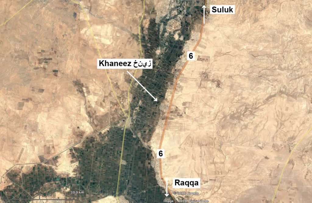
According to SOHR, the vehicle was hit on the road between Ar Raqqah and Suluk. Sira Press reported: “Activists stressed that all those who were in the car were unarmed civilians and there were four of them and that aircraft targeted them near the town of Khaneez, which led to the martyrdom of everyone in the vehicle.“
Sira Press also claimed that the coalition “also targeted a primitive oil refinery east of the village of Alhderatt [south east of Ain Issa], even though the refinery belongs to civilians who have nothing to do with Daesh.”
In what may be a related incident, the Violations Documentation Centre named a civilian male as having been killed in ‘Coalition shellnig’ at Suluk, though gave the date of death as June 19th.
In their monthly civilian casualty reports, the US-led Coalition has indicated that the credibility of this civilian harm allegation is in the process of being assessed.
Victims
Individuals
Key Information
Geolocation Notes
Reports of the incident mention an area in the vicinity of the village of Khaneez (خنيز or خنيزر جنوبي), on the road between Suluk (سلوك) and Ar Raqqah, known as Route 6. The coordinates for the area on Route 6 that is West of the village of Khaneez (خنيز) are: 36.2451039, 39.0351105

Map showing Route 6 and the village of Khaneez (خنيز)
Imagery: © 2018 Google
