Incident Code
Incident Date
Location
Geolocation
Geolocation
Airwars Assessment
(Previous Incident Code: S206 )
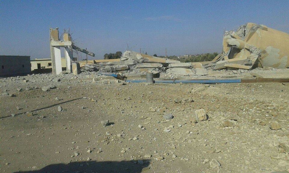
A reported Coalition airstrike on the agricultural secondary school in Manbij – being used as a temporary prison by so called Islamic State – led to the deaths of between 8 and 20 civilian captives according to local reports.
Smart News reported: “Our reporter explained that raids carried out by international coalition aircraft targeted a secondary agriculture college which is the headquarters of the IS prison in Manbij city center. It was destroyed completely, killing a number of prisoners inside, of whom Abd al Hanan al Sheikho [or al Hammoud] was identified, in addition to three civilians who were near the school. The reporter added – citing the Media Office of the City of Manbij – that a number of Islamic State elements were also killed.“
Al Araby al Jadid placed the death toll much higher at 30, with 50 injured – though this included Daesh fighters.
Manbij is the Mother of the World produced multiple reports on the incident. They said “the raid a short while ago on Manbij was near the old electricity company near Kosra Gas station and the second strike was near al Damourji road.“
Another report added that the first raid was on the agricultural school and that “there weren’t any prisoners inside it as the rumours said but the prisoners were inside the electricity company that was bombed at the same time as the school.
“Following the first raid on the school there was another one straight away on the old electricity company and another one near the al Damurji street near the house of Hajj Nabou.
“IS has transferred the prisoners and moved them to different places in the town. All the prisoners that were in the hotel have been moved to the security. Note: the water company was also targeted but with a lighter strike and there was no damage.”
Geolocation Notes
Reports of the incident mention the city of Manbij (منبج), for which the generic coordinates are: 36.5269242, 37.9559288. Due to limited satellite imagery and information available to Airwars, we were unable to verify the location further.