Incident Code
Incident Date
Location
Geolocation
Geolocation
Airwars Assessment
(Previous Incident Code: S642 )
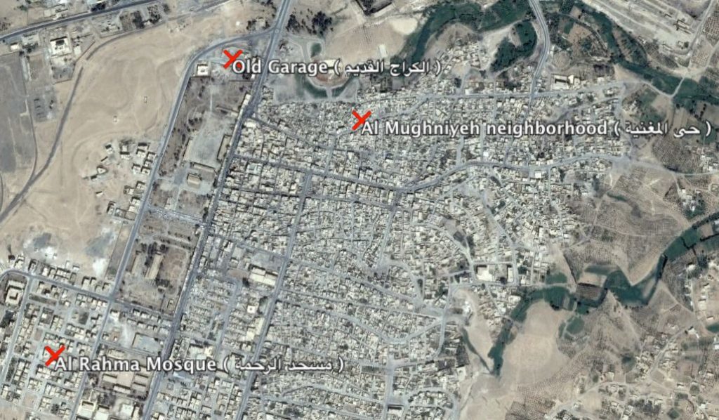
According to the Smart News Agency, likely Coalition “air raids raged in the southern neighborhoods of the city and were concentrated at Al Rahma Mosque and Al Ajili Pharmacy, as well as Al Mughniyeh neighborhood and the Old Garage, killing four civilians and injuring seven others, according to another local source.”
Syrian Mirror also put the death toll at four and blamed the Coalition.
Geolocation Notes
Reports of the incident refer to areas in the South of Tabaqa. Open source maps locate Al Rahma Mosque (مسجد الرحمة) at 35.832161, 38.537491; Old Garage (الكراج القدیم) at 35.841667, 38.543611; Al Mughniyeh neighbourhood (حي المغنیة) at 35.839744, 38.548814. We are able to unable to geolocate Al Ajili Pharmacy (صیدلیة العجیلي).
Locations name in local reports of the incident.
Imagery: © 2018 Google