Incident Code
Incident Date
Location
Geolocation
Geolocation
Airwars Assessment
(Previous Incident Code: S1164 )
Two named children died in an alleged Coalition airstrike on a school in the village of al Hammadi in the al Shadadi countryside, according to local media.
Multiple sources reported that the Haddaj Sharqi school was struck by the Coalition, killing two children.
Victims
Individuals
Geolocation Notes
Reports of the incident mention Haddaj Sharqi (East) school (ﻣﺪﺭﺳﺔﻫﺪﺍﺝﺷﺮﻗﻲ), al Hammadi village (ﻗﺮﻳﺔﺍﻟﺤﻤﺎﺩﻱ ) in al Shadadi (ﺍﻟﺸﺪﺍﺩﻱ ) countryside near the Iraqi border, Al-Hasakah governorate. Due to limited satellite imagery and information available to Airwars, we were unable to verify the coordinates of either al Hammadi village (ﻗﺮﻳﺔﺍﻟﺤﻤﺎﺩﻱ) or the school. There are three buildings labeled as schools on Wikimapia east of Haddaj village and near the Iraq/Syria border, but it is unclear if any of these are the school that was reported to have been targeted. The coordinates for these three schools are: 36.017222, 41.207778; 35.977500, 41.247222; and 35.961667, 41.203889. We did locate al Shadadi town (ﺍﻟﺸﺪﺍﺩﻱ ), for which the coordinates are: 36.052222, 40.728889, and Haddaj village (حداج), for which the coordinates are: 36.035833, 41.056389.
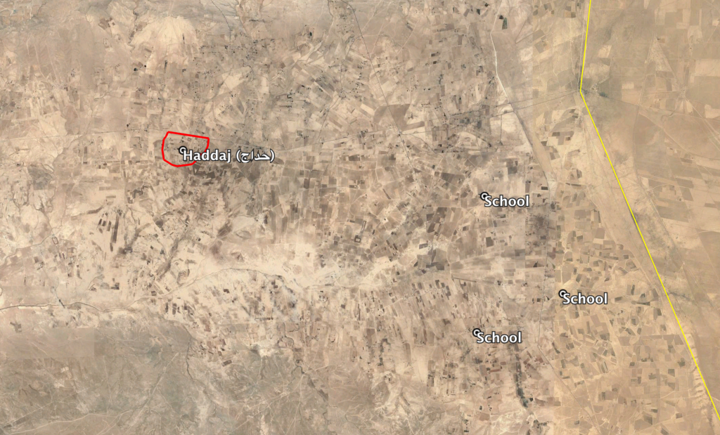
Three possible locations for the school east of the village of Haddaj (حداج) and near the Iraq/Syria border
Imagery: © 2019 Google