Incident Code
Incident Date
Location
Geolocation
Geolocation
Airwars Assessment
(Previous Incident Code: S1358 )
Local sources reported “a number of civilians were killed” following airstrikes they believed were likely conducted by US-led Coalition aircraft.
According to sources, the bombs contained white phosphorous – a chemical weapon sometimes proscribed under international law.
Al Mayadeen, a pro-regime news organisation, reported “the attack [allegedly by the Coalition] led to the deaths of 3 civilians and wounding 5 others and significant material damage to public and private property.”
There are currently no further details regarding civilians casualties, Airwars will amend the entry when new information arises.
Geolocation Notes
Reports of the incident mention that the alleged Coalition airstrike targeted the neighbourhood of Safia (صفیة) in the southern outskirts of the village of Al Suwar (الصور), northern Deir Ezzor. The coordinates for this neighbourhood are: 35.494709, 40.644693.
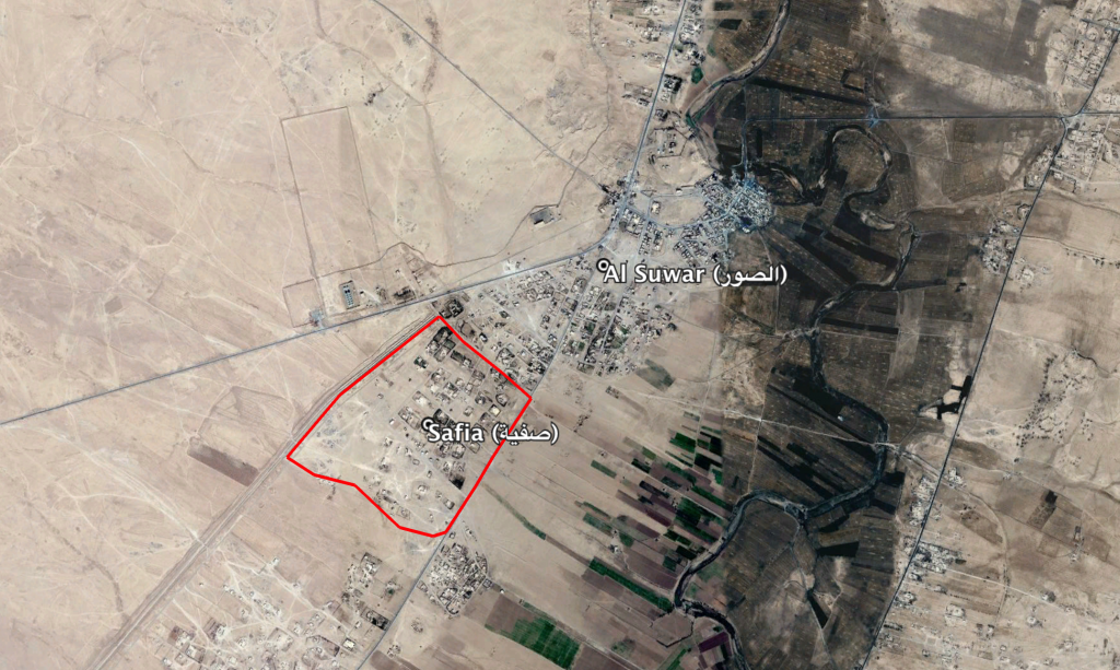
Safia (صفیة) neighbourhood, southern outskirts of Al Suwar (الصور)
Imagery: © 2019 Google