Incident Code
Incident Date
Location
Geolocation
Geolocation
Airwars Assessment
(Previous Incident Code: S1391 )
Local sources reported that 16 to 45 people were killed in a mass civilian casualty incident on al Tawassi’ya neighbourhood, Raqqah city. Some reports said that a shelter in the Traffic park area had been struck, while others said two buildings were hit.
The lowest overall death toll of “at least 19” came from the Syrian Network for Human Rights; the second highest was 40 killed, including women and children, documented by Raqqa Post. All other sources documented 45 deaths. Every source blamed the US-led Coalition for the attack.
The Euphrates Post reported that 16 civilians from one family died in a “massacre” reportedly carried out by the Coalition on a “residential building” in al Tawassi’ya.
The airstrikes reportedly targeted buildings in an area in which civilians were situated according to Amir al-Abbad, an Al Jazeera correspondent.
Further detail was provided by @Q_Alensy who alleged that two buildings in the neighbourhood, west of Baladi Stadium were targeted by the Coalition resulting in the loss of civilian life. UNOCHA noted in a later report that “On 2 October, an airstrike hit a water well located in the outskirts of the Al-Tawassoiya area in the north of Ar-Raqqa city, reportedly killing 45 civilians.”
On February 13th, Reporters without Borders stated “a number of bodies” were recovered from the Al Tawassi’ya neighbourhood, near Al-Ansar mosque. After a query from an Airwars researcher, the local source confirmed that over 45 civilians had been killed. The organization later sent Airwars photos of the bodies that had been pulled from under the rubble.
Geolocation Notes
Reports of the incident mention the neighbourhood of Al Tawwasiya (التوسعیة), for which generic coordinates are: 35.9633318, 38.9806321. Reports also mention strikes on residential buildings close to the Traffic park, near the Al Ansar mosque (الأنصار), for which the coordinates are: 35.959724, 39.001615.
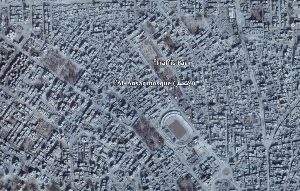
Airstrikes struck residential buildings close to the Traffic park near the Al-Ansar mosque (الأنصار)
Imagery: © 2018 Google