Incident Code
Incident Date
Location
Geolocation
Geolocation
Airwars Assessment
(Previous Incident Code: S1399)
Seven civilians, including four children and two women, reportedly died following alleged US-led Coalition air strikes on al Badou neighbourhood, Raqqah city.
Details of the death toll were initially provided by one source only, the Syrian Network for Human Rights, which blamed the Coalition. Raqqa is Being Slaughtered also referred to air raids carried out by the Coalition on the neighbourhood, in conjunction with “intense artillery shelling”, with the source noting that the attacks occurred amid extensive bombardment of the neighbourhoods “Tawasu’iya, Bedou, Shihada’a, train street”. Moreover, RBSS documented “more than 117 air raids and about 1,500 artillery shells targeted the city during the past three days”.
Later reports said that Sadeed Al-Hallaq his wife, seven children, his father and his mother were killed. All sources attributed the incident to the US-led Coalition.
Key Information
Geolocation Notes
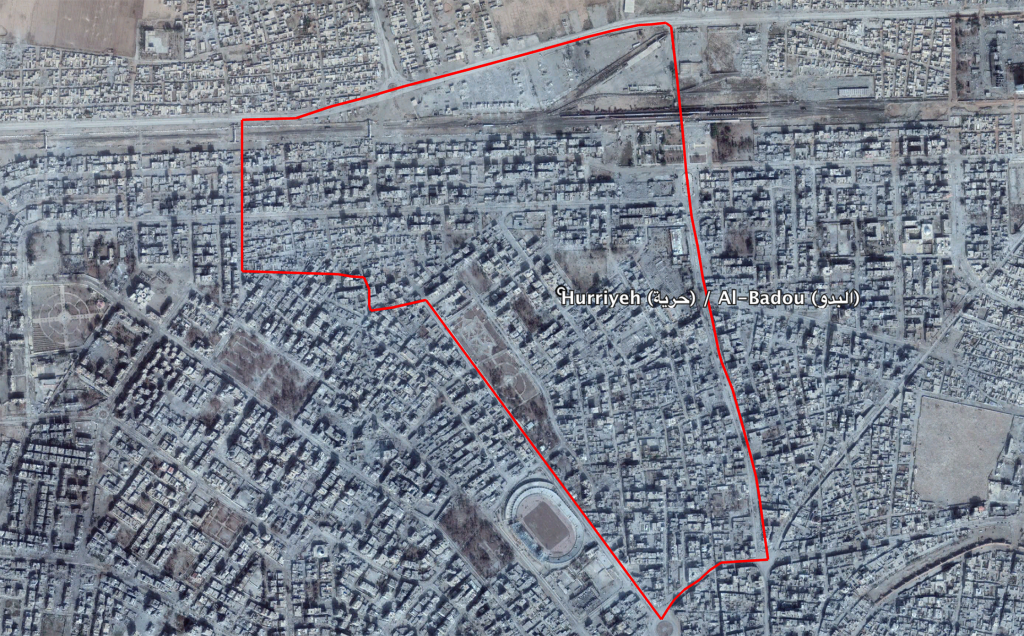
Reports of the incident mention the neighbourhood of Al Badou (البد), for which the coordinates are: 35.961778, 39.006083.

The neighbourhood of Al Badou (البد) in the city of Raqqa
Imagery: © 2018 Google
