Incident Code
CI011
Incident Date
17 October 2014
Location
Bojeel, Salah Al Din, Iraq
البوعجيل
Geolocation
34.577822,
43.724728
Accuracy: Village
Geolocation
34.577822,
43.724728
Accuracy: Village
Airwars Assessment
Last Updated: December 15, 2024
(Previous Incident Code: I009a )
Reports claimed that Coalition strike hit a mosque during Friday prayers in the town of Al Bojeel, to the east of Tikrit.
Geolocation Notes
Reports of the incident mention (البوعجيل) Al Bojeel village, East of Tikrit. The coordinates for (البوعجيل) Al Bojeel are: 34.577822, 43.724728
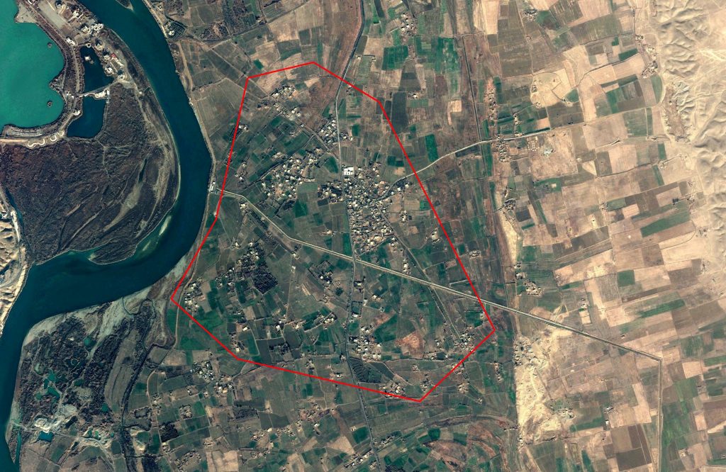
Al Bojeel ( البوعجيل )
Imagery: © 2018 Google
Military Statements
U.S.-led Coalition Assessment
Suspected belligerent
U.S.-led Coalition
U.S.-led Coalition position on incident
Non credible / Unsubstantiated
Reason for non-credible assessment
No Coalition strikes were conducted in the geographical area
Civilian deaths conceded
None
Civilian injuries conceded
None
Stated location
near Abu Ujail, Tikrit, Iraq
U.S.-led Coalition Strike Report
No publicly reported Coalition strike appeared to match the event. However for October 17th-18th 2014 it was reported that “five airstrikes occurred south and west of Bayji and struck two ISIL units, destroyed one ISIL armed vehicle, an ISIL heavy weapon, an ISIL machine gun position, an ISIL building and three ISIL guard shacks and damaged one ISIL guard shack.”
U.S.-led Coalition Civilian Casualty Statement
2018-07-26
Original Source ↗
After a review of available information it was assessed that no Coalition strikes were conducted in the geographical area that correspond to the report of civilian casualties.