Incident Code
Incident Date
Location
Geolocation
Geolocation
Airwars Assessment
(Previous Incident Code: I045b )
Four coalition strikes allegedly hit the village of Roumana near al Qaim, in Anbar province. According to the Baghdad Center for Human Rights, an unspecified number of non-combatants died in the event. Islamic State may have been the source for those claims, which it made on one of its websites.
Geolocation Notes
Reports of the incident mention the village of Rumaneh (الرمانة), in the Qa’em area. The coordinates for the midpoint of the village of Rumaneh (الرمانة) are: 34.39381, 41.07954. Satellite imagery available to Airwars from April 2016 shows structural damage to a building in the area, for which the coordinates are: 34.39892, 41.08080. The year long window between the incident and the date of the image means this may be a separate incident, however, it should not be discounted
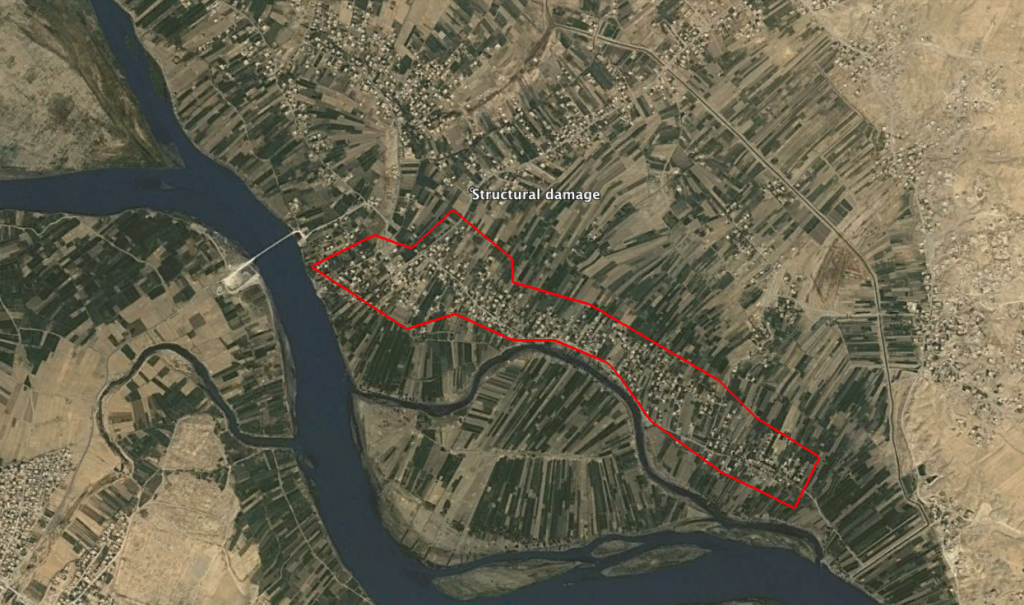
The village of Rumaneh (الرمانة) and the location of structural damage seen on satellite imagery
Imagery: © 2018 Google