Incident Code
Incident Date
Location
Geolocation
Geolocation
Airwars Assessment
(Previous Incident Code: S008)
According to the Syrian Observatory for Human Rights, a coalition airstrike “on Islamic State buildings” killed “several” civilians who were being held captive, as well as five Islamic State militants.
The full translated quote from SOHR reads as follows: “Also at least five members of the Islamic State were killed and others wounded following a raid carried out by the International/Arab coalition aircraft on an IS building on the road between Manbij and Jarabulus. There were also reports of deaths and injury of several civilians who were detained by the organization in that building.”
In its monthly civilian casualty report for October 2019 – published on December 5th of that year, the Coalition assessed the event as ‘non credible’, noting that “September 28, 2014, on the road between Manbij and Jarabulus, Syria, via Airwars report. After a review of all available records it was assessed that no Coalition actions were conducted in the geographical area that corresponds to the report of civilian casualties.”
Coalition officials also provided Airwars with a geolocation to within 100 metres of the area reviewed.
Key Information
Geolocation Notes
Reports of the incident mention an “IS building” on the road between ( منبج ) Manbij and( جرابلس ) Jarablus. The road is number 216. There was no further information on the location on the building. The coordinates for the middle point of Road 216 between Mabij and Jarablus are: 36.6268445, 37.9348657 Location of ( منبج ) Manbij: 36.5269242, 37.9559288 Location of ( جرابلس ) Jarabulus: 36.818378, 38.010343
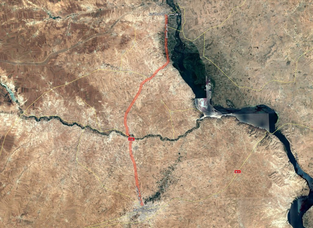
Road 216 Mabij-Jarablus