Incident Code
CS1461
Incident Date
9 September 2017
Location
Sabha and al Jadid crossing, Deir Ezzor, Syria
Geolocation
35.258358,
40.330682
Accuracy: Neighbourhood/area
Geolocation
35.258358,
40.330682
Accuracy: Neighbourhood/area
Airwars Assessment
Last Updated: December 15, 2024
(Previous Incident Code: S1284)
A single source, LCCSY, reported that “two people were injured in the air raids of the International Alliance on the slopes of Al-Sabha and Al Jadid in the eastern countryside”.
No further details are currently available.
Key Information
Country
Military Actor
Civilian Harm Reported
Yes
Civilian Harm Status
Weak
Civilians reported injured
2
Geolocation Notes
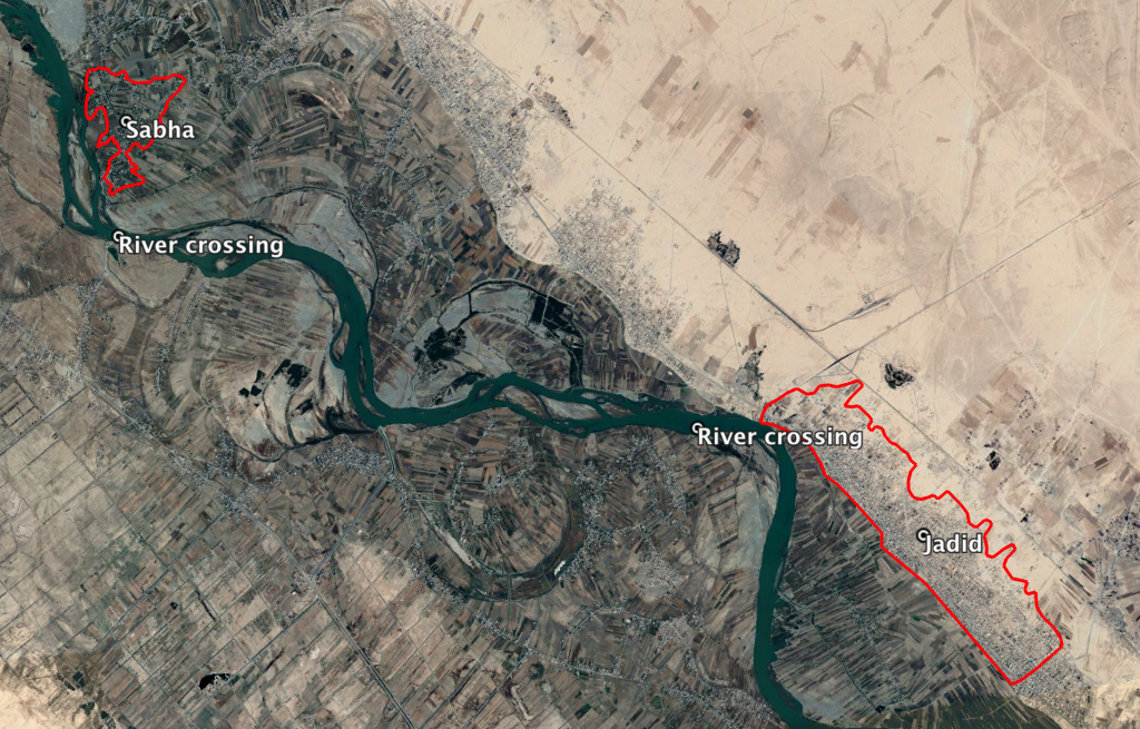
Reports of the incident mention the Sabha and Jadid river crossings (معبر صبحة والجدید). Two possible locations for these river crossings are: 35.258358, 40.330682 (Jadid) and 35.284181, 40.234852 (Sabha)

Two possible locations for the reported river crossings
Imagery: © 2018 Google
Military Statements
U.S.-led Coalition Assessment
Suspected belligerent
U.S.-led Coalition
U.S.-led Coalition position on incident
Non credible / Unsubstantiated
Reason for non-credible assessment
No Coalition strikes were conducted in the geographical area
Civilian deaths conceded
None
Civilian injuries conceded
None
Stated location
near Sabha and al Jadid crossing, Deir Ez Zor, Syria
Location accuracy
100 m
MGRS coordinate
37SFV210025
U.S.-led Coalition Strike Report
For September 8th – 9th the Coalition publicly reported no strikes in the vicnity of Dayr Az Zawr.
For September 9th – 10th the Coalition reported “Near Dayr Az Zawr, three strikes engaged an ISIS tactical unit and destroyed two fighting positions and a vehicle.”
UK Military Strike Report
‘Saturday 9 September – a Reaper destroyed a motorcycle and trailer carrying three terrorists north-east of Dayr az Zawr… The following day [Sept 9th], another Reaper flew a further patrol in the same area of Syria, and tracked a group of three terrorists on a motorcycle and trailer. The Reaper’s crew waited patiently until the targets were in open countryside before firing a Hellfire which scored a direct hit.’
U.S.-led Coalition Civilian Casualty Statement
2018-06-28
Original Source ↗
After a review of available information it was assessed that no Coalition strikes were conducted in the geographical area that correspond to the report of civilian casualties
