Incident Code
Incident Date
Location
Geolocation
Geolocation
Airwars Assessment
(Previous Incident Code: S1357)
Between 21 and 40 civilians, the majority women and children, were reported killed in alleged US-led Coalition airstrikes on Al Badou neighbourhood, Raqqah city.
Initially the citizen journalist group, Raqqa is Being Slaughtered Silently (RBSS), reported 40 civilians were killed following alleged US-led Coalition. According to RBSS, the strikes hit an apartment building and all of “the bodies are still under the rubble”. RBSS described the aircraft responsible as a “B52 plane”. The media wing of ISIS also claimed that the same number of civilians died.
A subsequent report from the Syrian Network for Human Rights alleged “at least 21” died following US-led Coalition raids on Al Badou neighbourhood. Smart then reported 40 dead and “dozens” injured, after Coalition planes reportedly conducted airstrikes on an apartment building in the area.
Qasioun said the death toll was 30, whilst RFS reported 40 – mostly women and children. All sources said the US-led Coalition was responsible.
Key Information
Geolocation Notes
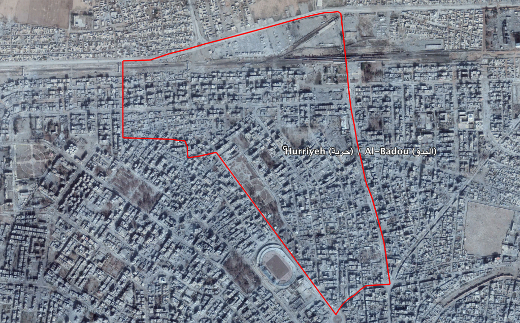
Reports of the incident mention that the airstrikes or artillery targeted an apartment building in the neighbourhood of Badou (البدو) in the city of Raqqa. The coordinates for the neighbourhood of Badou (البدو) are: 35.961778, 39.006083.

The neighbourhood of Al Badou (البد) in the city of Raqqa
Imagery: © 2019 Google
