Incident Code
Incident Date
Location
Geolocation
Geolocation
Airwars Assessment
(Previous Incident Code: S1397)
Between 13 and 21 civilians reportedly died following airstrikes on al Shuhadaa neighbourhood north of Raqqah city, according to local sources. The civilians were said to have gathered around a water well in the area. This was the second reported attack on the city’s water supply in two days.
Shahba Press said it had documented 13 killed, including seven children and “dozens” wounded, Fifteen were allegedly killed by Al Raqqa Truth. All other sources suspected 13 killed and all bar three directly blamed the US-led Coalition.
UNOCHA also blamed the Coalition, noting in a later report that “On 3 October, airstrikes in Al-Shuhadaa neighbourhood in northern Ar-Raqqa city also hit water wells where a group of civilians were gathering, reportedly killing at least 21 people, including three children, and injuring many others. As a result, the last two wells in the city reportedly became inoperable.”
Key Information
Geolocation Notes
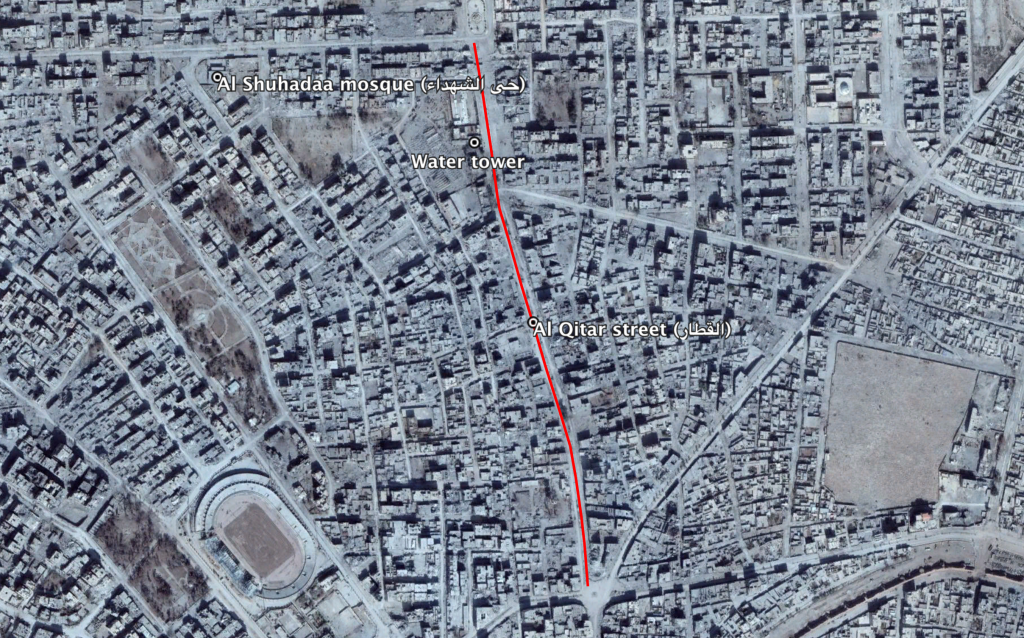
Reports of the incident mention the neighbourhood of Al Shuhadaa mosque (لشهداء حي) near the water tower on Al Qitar street (القطار), for which the approximate coordinates are: 35.963770, 39.007897. Sources mention that strikes “hit water wells where a group of civilians were gathering (…). As a result, the last two wells in the city reportedly became inoperable.”

Reports of the incident mention the neighbourhood of Al Shuhadaa mosque (لشهداء حي) near the water tower on Al Qitar street (القطار).
Imagery: © 2018 Google
