Incident Code
Incident Date
Location
Geolocation
Geolocation
Airwars Assessment
(Previous Incident Code: S507)
Between one and two civilians died and up to five were injured in an alleged Coalition airstrike on the Al Thani and Awwal neighbourhoods of Al Tabaqa, according to local sources.
According to Smart News, “local sources reported the death of one civilian and wounding of others, on Wednesday evening, as a result of aerial bombardment likely carried out by the international Coalition on Al Tabaqa city (55 km west of Raqqa). “The source told Smart that the warplanes launched two raids on the first and second neighbourhoods, killing one civilian and wounding five others, who were taken to the National Hospital in the city.”
Micro Syria also blame the Coalition putting the death toll at one civilian.
Hewar.Khayma said that two were killed – though it didn’t identify who the warplane responsible belonged to. A tweet by Abdulbaset10 had noted “An American warplane B52 is flying over Tabaqa city now.”
The Coalition itself has denied conducting strikes in the geographic area that corresponded to claims of civilian harm on this date.
Key Information
Geolocation Notes
Reports of the incident mention Al Thani/Hurriyah (Second) neighbourhood (لحي الثاني) and Al Wahdah (First) neighbourhood (الحي الأول). The coordinates for Al Thani (لحي الثاني)are: 35.846667, 38.543889. The coordinates for Al Wahdah (الحي الأول) are: 35.850000, 38.553333. Airwars assessment uses a midpoint between the two: 35.8489, 38.5499.
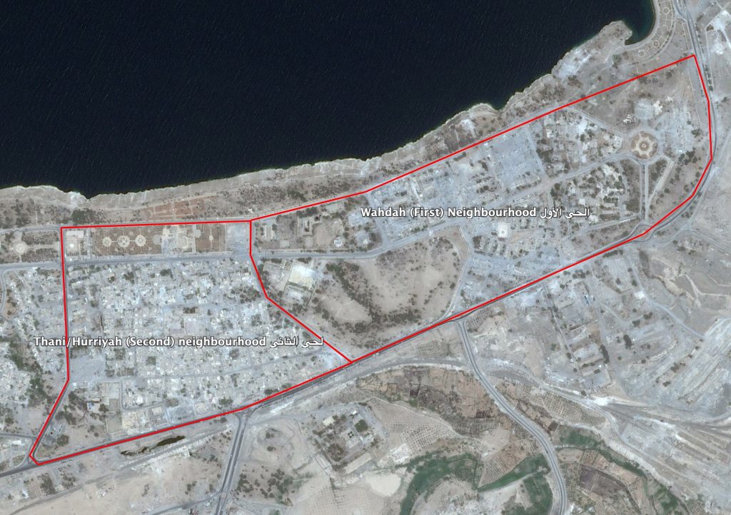
Thani/Hurriyah (Second) (لحي الثاني) and Wahdah (First) (الحي الأول) neighbourhoods
Imagery: © 2018 Google