Incident Code
Incident Date
Location
Geolocation
Geolocation
Airwars Assessment
(Previous Incident Code: S811)
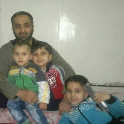
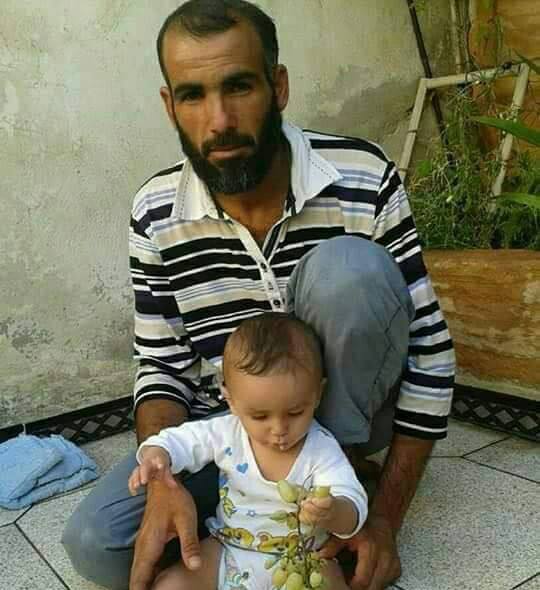
Between seven and 13 civilians including three children and one woman from the same family died in airstrikes and/or rocket strikes on different locations in Raqqa, local media reported. While reports blame the Coalition, many also pointed towards artillery shelling by both US forces and Kurdish units.
Raqqa is Being Slaughtered Silently published “photos showing the destruction in National Bank of Credit and the Civil Engineering College area following Coalition raids”. It later posted images “of the signs of destruction caused by the air raids on the University road, al Bustan restaurant and al National Bank of Credit”, which were taken from a video by the IS media agency A’Amaq, published by Al Ragga Truth.
Among the sources blaming the Coalition, were the Syrian Network for Human Rights and the Syrian Observatory for Human Rights.
However, some sources noted that Coalition airstrikes coincided with artillery strikes. According to Qasioun, for example, while the Coalition “intensified its airstrikes”, the city also came under from “artillery and missile attacks by Kurdish units”.
Sound and Picture noted that “six rockets were fired from the Kharab_Ashk base, controlled by US forces, towards the city of Raqqa”, while Al Raqqa Truth published footage depicting the aftermath of “American air and artillery shelling on al Mansour and al Nour street”.
Overall, local reports of strikes cite the following locations:
- Al Baraka station on Saif al-Dawla Street
- The Building for Immigration and Passports in Al Thakana neighbourhood
- Mashbal neighbourhood
- Muraba’ Amni, “Security Box” area
- National (Popular) Bank of Credit area
- University Road
- Al Bustan restaurant
- Civil Engineering College area
- Hussein Mosque, next to the Faculty of Education
- The train station
- Hijra and Jawazat neighbourhoods
Victims
Family members (5)
Individuals
Key Information
Geolocation Notes
Overall, local reports of strikes cite the following locations: The coordinates for Saif al Dawla Street (شارع سیف الدولة) are: 35.940417, 39.019056. We were unable to geolocate the building for immigration and passports in Al Thakana. However, the generic coordinates for Al Thakana (الثكنة) neighbourhood are: 35.946881, 39.006154. The coordinates for the train station (محطة القطار) are: 35.965806, 39.010167. The coordinates for Mashbal (حي المشلب) neighbourhood are: 35.944944, 39.047472. The coordinates for the Muraba’ Amni, “Security Box” area (المربع الامني) are: 35.949369, 39.007444. The coordinates for the National Bank of Credit (مصرف التسليف الشعبي) are: 35.945077, 39.015770. The coordinates for Hussein Mosque (مسجد الحسین), next to the Faculty of Education are: 35.963859, 39.017052. Note, damage is visible in satellite imagery in the vicinity of Faculty of Education (كلیة التربیة) and Mosque of Hussein at: 35.9633492, 39.0190762.
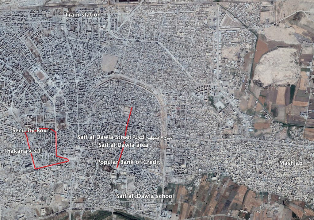
Locations named in local reports
Imagery: © 2018 Google