Incident Code
Incident Date
Location
Geolocation
Geolocation
Airwars Assessment
At least one man was killed and “many” wounded in alleged Turkish fire in the city of Al Bab, Aleppo governorate, on November 17th, 2019, according to Hawar News Agency.
The men were reportedly taking part in a demonstration against the Turkish invasion of the city. Hawar News Agency wrote that civilians were attacked with “real bullets and gas bombs” by “Turkish soldiers and gangs”.
Geolocation Notes
Reports of the incident mention soldiers opening gunfire on a demonstration in the city of Al Bab (الباب). Investigating audio-visual material from sources, we have narrowed this location down to the entrance of Al Bab Police Station (مركز شرطة الباب), for which the exact coordinates are: 36.368250, 37.513367.
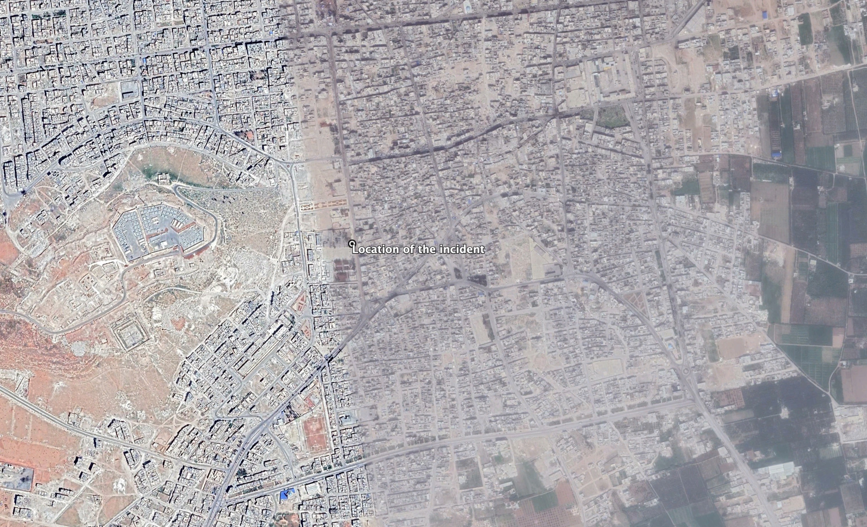
Reports of the incident mention soldiers opening gunfire on a demonstration in the city of Al Bab (الباب). Investigating audio-visual material from sources, we have narrowed this location down to the entrance of Al Bab Police Station (مركز شرطة الباب).
Imagery: Google Earth
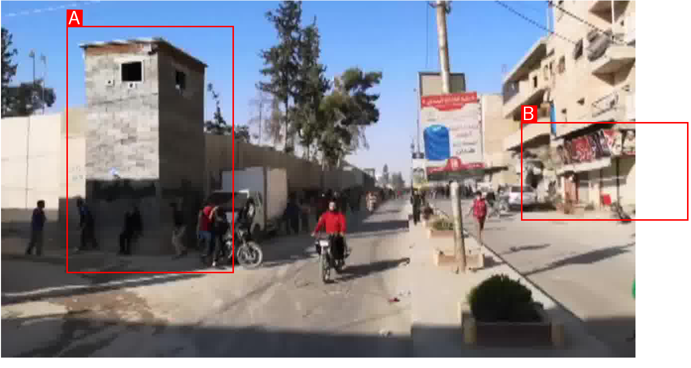
Panoramic stitch of footage from the incident. Tag A seems to be connected to a small road road which appears barely visible on the satellite imagery available to Airwars.
Imagery: Hewar News
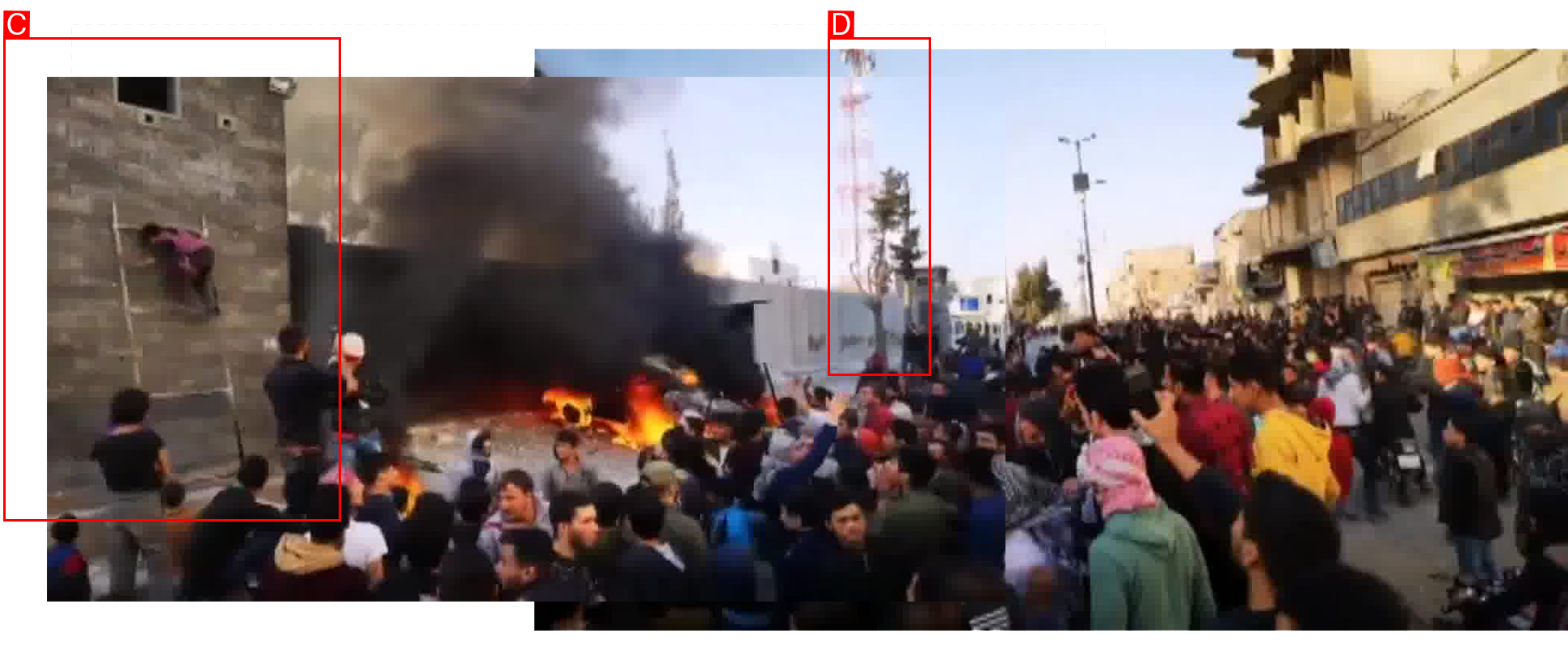
Panoramic stitch of footage from the incident.
Imagery: Hewar News
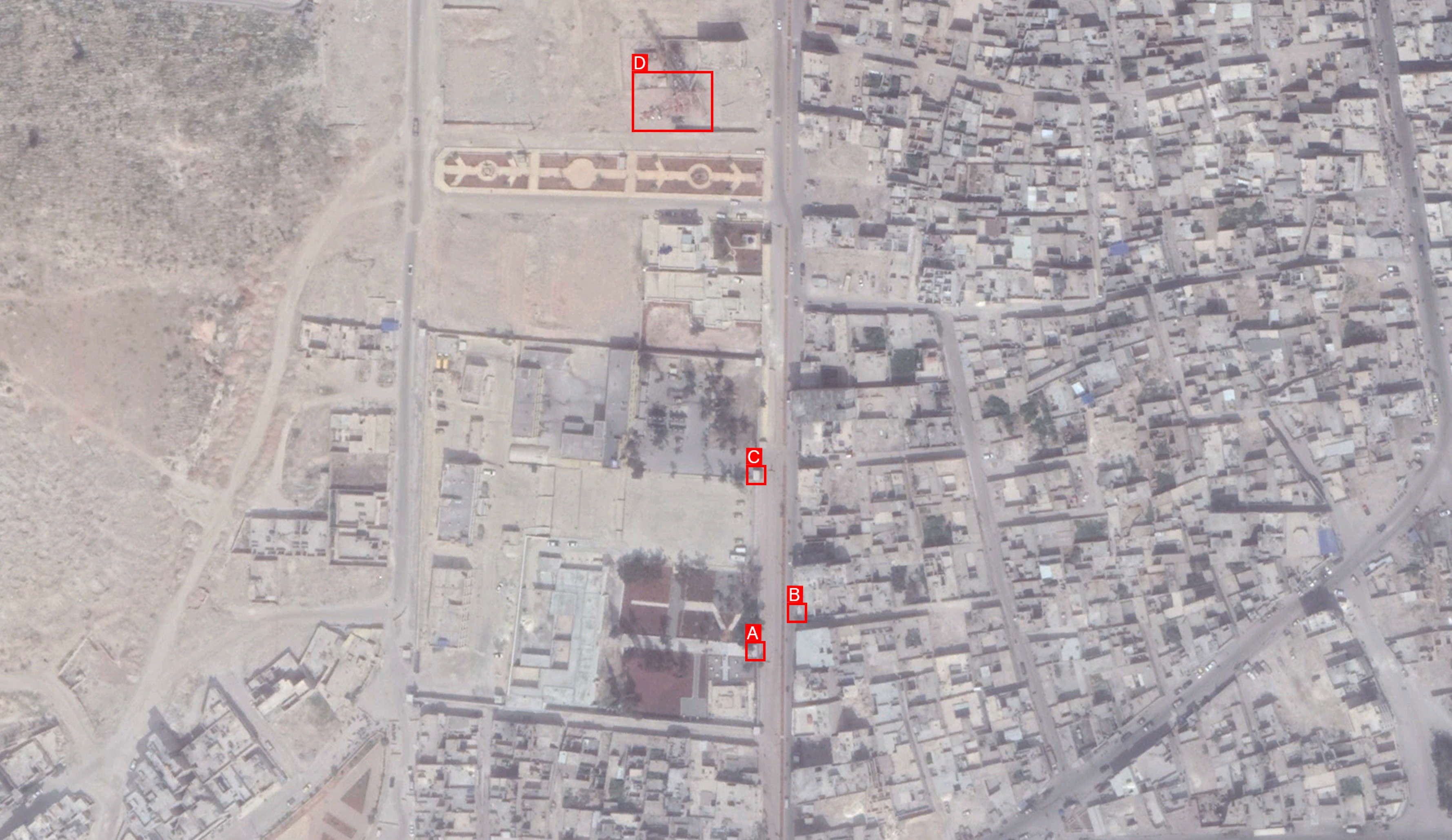
Satellite imagery showing the distribution of buildings tagged in the panoramic stitches.
Imagery: Google Earth