Incident Codes
Incident Date
Location
Geolocation
Geolocation
Airwars Assessment
(Previous Incident Codes: S1311 R2298 RS2443 )
Between seven and nine civilians died including three children and one woman and up to 17 others were wounded in airstrikes on the al Qasr area of Bokros Tahtani, according to local media – though sources were conflicted as to whether the Coalition, Russia or the Syrian regime were responsible.
The Step News Agency and the Syrian Observatory for Human Rights pointed towards Coalition airstrikes. However most other sources including Al Araby, Orient and Sharqiya Voice, blamed Russia.
According to Sharqiya, “a Russian warplane targeted the village of Bokros Tahtani, and in particular civilian homes on al Qasr Road in the centre of the village, killing nine civilians and wounding more than 17 others, in addition to the destruction of houses.”
Deir Ezzor24 reported that warplanes “bombed a group of civilians near a car who were distributing bread in the village.” Other sources said that the strikes occurred near al Qasr school.
Orient News reported “a total of 14 martyrs, mostly women and children, killed and a number of others injured as a result of Russian air strikes targeting the towns of Baqrass Tahtani and Khasham in the village of Deir al-Zour with rockets and cluster bombs.”
However, the Syrian Network for Human Rights blamed the regime, reporting: “6 civilians, including 3 children and a woman, killed in Syrian regime warplanes missiles fired on Buqrus Tahtani village in Deir Ez-Zour governorate eastern suburbs, September 14, 2017.”
Euphrates Post also said that Khader Sa’id al-Nizhan died as a result of injuries sustained in an attack by warplanes on September 14th – though the source later told Airwars that the event occurred in Al Mayadin.
Victims
Individuals
Geolocation Notes
Reports of the incident mention the Al Qasr (القصر) area in the village of Bokros Tahtani (بقرص تحتاني). One source describes the place as near Al Qasr school, from the road of Badia. Airwars geolocated photos of a destroyed building to this location: 35.057081, 40.411497. Satellite imagery available to Airwars suggests that the building was destroyed between 12 and 22 September, 2017
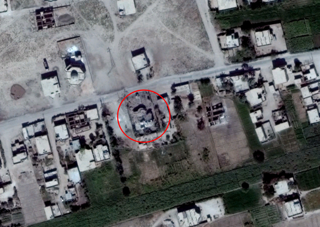
Structural damage seen to the building on October 1st, 2017
Imagery: © 2018 Google
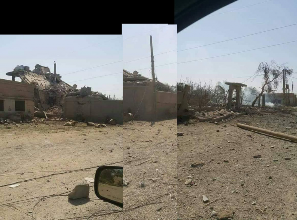
Based on this panorama composed of available media, Airwars was able to geolocate the destroyed building