Incident Code
Incident Date
Location
Geolocation
Geolocation
Airwars Assessment
(Previous Incident Code: S081 )
Coalition aircraft allegedly struck a three-wheeled motorcycle or ‘tirterah’ which was carrying a vegetable farmer. Raqaa is Being Slaughtered Silently later published a graphic image of the aftermath.
The victim was identified as a resident of Hamam al-Turkman near Ar Raqqah.
In April 2019, the Coalition accepted responsibility for this event, noting: “Coalition aircraft conducted a strike on Daesh terrorists. Regrettably, two civilians, and possibly a third, in passing vehicles (a bongo truck and a three-wheeled motorcycle) were unintentionally killed due to the proximity of the strike.”
In July 2019, the Coalition provided Airwars with the location of this event, accurate to within a 100 metre box.
Victims
Individuals
Geolocation Notes
Reports of the incident mention that the alleged Coalition airstrike targeted a convoy of civilian cars on Route 6, West of the village of Khaneez (خنيز), for which the coordinates are: 36.2451039, 39.0351105. Raqqa Is Being Slaughtered Silently located the airstrike on the road between Slouk and Al Raqqa, in the vicinity of the village of Khaneez (خنيز). The report was accompanied by a photograph of the victim who had been driving a three-wheeler motorbike (a tirterah). Shadows visible in that photograph taken soon after the incident indicate that the strike occurred in a four hour window, between 10:00 and 14:00 local time. Prior to the Coalition releasing the MGRS for this incident, Airwars had geolocated it to the nearest neighbourhood/area at 36.2451039, 39.0351105
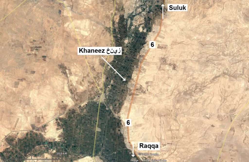
Map showing Route 6 and the village of Khaneez (خنيز)
Imagery: © 2018 Google
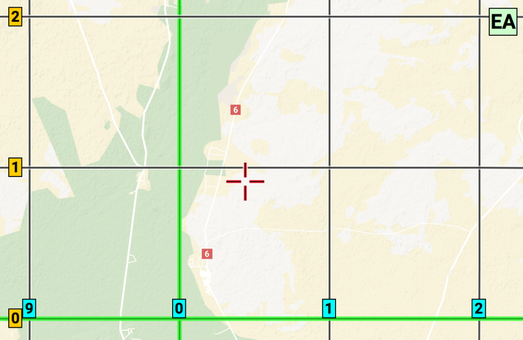
The location of the strike is probably in the MGRS coordinates 37SEA00 or 37SEA01